
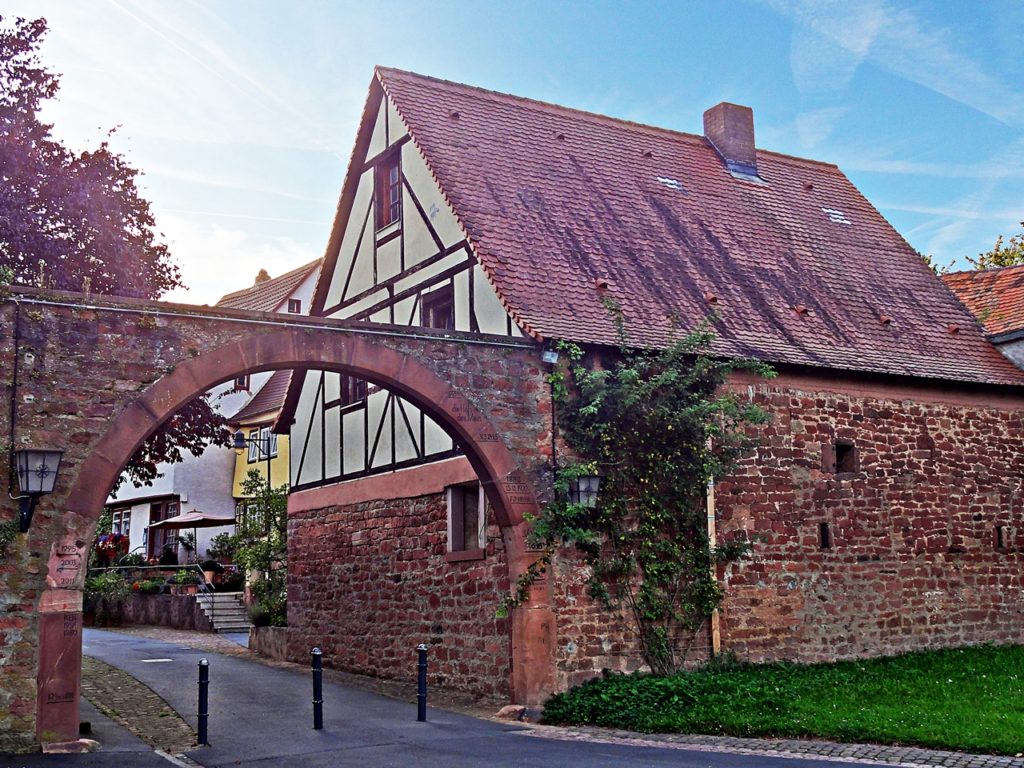
Town Wall and “Hecke” (“Hedge”)

Nr. on the small map: 5 (Kleinheubach) The oldest part of Kleinheubach, alongside the Marktstraße, was surrounded by a high wall where several parts still can be found at the longitudinal sides and the Rudenauer Creek. The gates at the upper and lower ends were demolished. The green center of the street quadrangle, the so […]
DenkOrt Deportationen 1941 – 1944
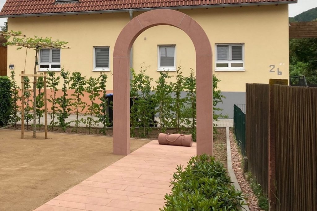
Kleinheubach is part of the decentralized monument “DenkOrt Deportationen 1941 – 1944”. The municipal administration designed a dignified DenkOrt (“place of commemoration”) for the Jewish citizens, who had been deported from Kleinheubach. Here you find the rolled up blanket made from sandstone, which commemorates the fate of the deportees; a second rolled up blanket is […]
Historic Town Hall Kleinheubach
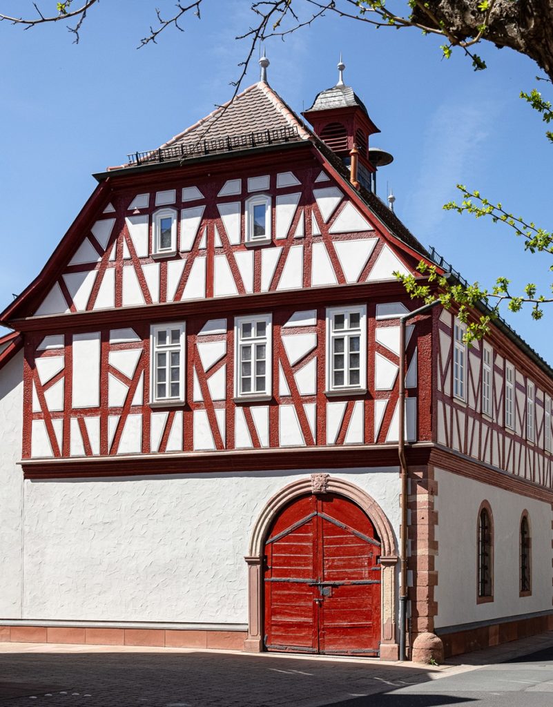
Nr. on the small map: 4 (Kleinheubach) Set on top of a predecessing building, the town hall was built in 1728 with a masoned ground floor supporting a half-timbered upper floor. The eaves side protrudes to the Marktstraße and provides a passage with two archways. The capstones of those archways show the earliest version of […]
Fahrgasse
Nr. on the small map: 3 (Kleinheubach) Ferrymen would live in the Fahrgasse because at the end of the road, at the Main-River, the ferry was anchored, crossing over to Großheubach, from where the trade-route Eselsweg (Donkey Trail) crossed the Spessart connecting our region to (Bad) Orb. Ferry rights belonged to some families of Kleinheubach, […]
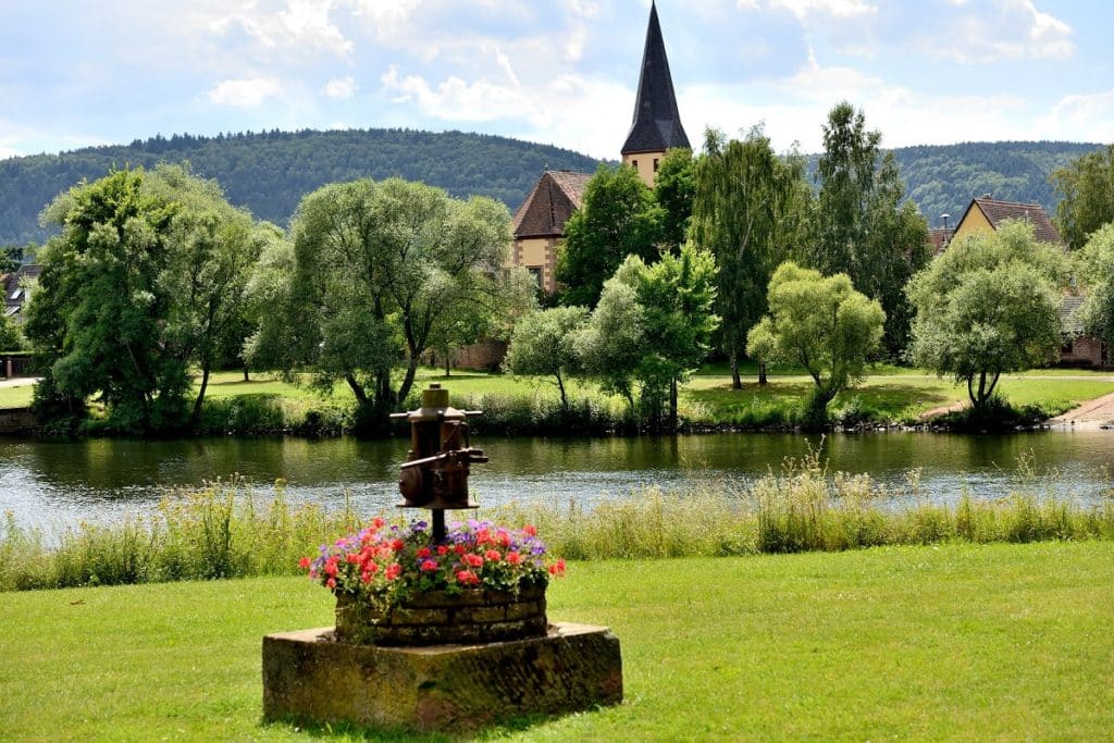
Lutheran Church St. Martin inside the Fortified Church Yard
Nr. on the small map: 2 (Kleinheubach) The area around St. Martin was the origin of Kleinheubach, because this fortified church was located close to the Main-River on higher ground and therefore not endangered by floods. The former enclosing wall is stunning but was only retained at the riverside; inside the church yard you can […]
The Historic Town Centre, a Street Quadrangle
Nr. on the small map: 1 (Kleinheubach) The historic Town Centre of Kleinheubach is formed by a street quadrangle which at first sight appears to be a standardized and planned layout, but where each of the four streets actually emerged in different centuries. The slightly bent Marktstraße forms the original part. It used to be […]
Bodenstation (Soil Site in the Vineyards)
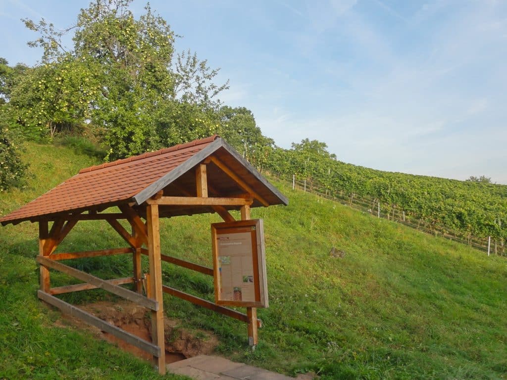
Nr. on the small map: 16 (Bürgstadt) The so-called soil site in Bürgstadt is one of currently seven soil sites in the vineyards around Lower Franconia and part of an initiative of the Bavarian State Office for the Environment, to raise awareness for land and soil. Educational trails on soil/land and soil sites are supposed […]
Centgrafenkapelle (unfinished chapel)
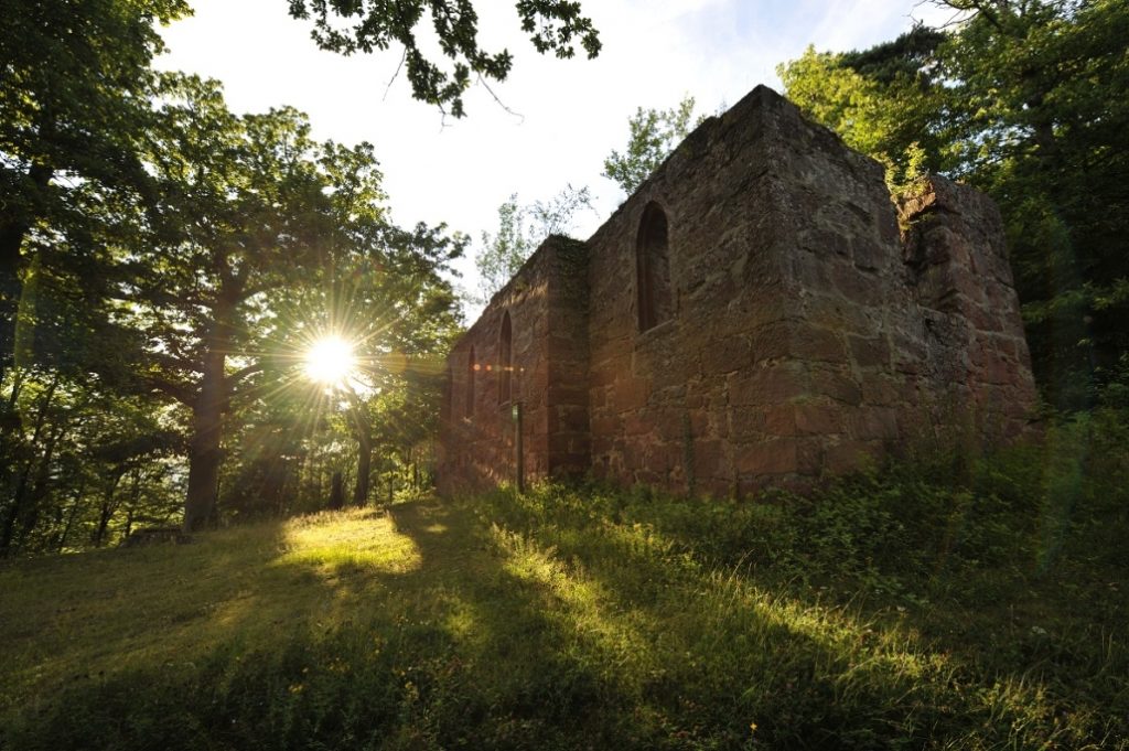
Nr. on the small map: 15 (Bürgstadt) The Centgrafenkapelle in the Bürgstadt Forest is unique. In 1630, the construction started, ordered by Centgraf Leonhard Gackstatt, but had to be left unfinished within the year, due to the Swedish invasion during the Thirty Years War. The reason why the chapel has never been concluded and remained […]
Prehistoric Ringfort
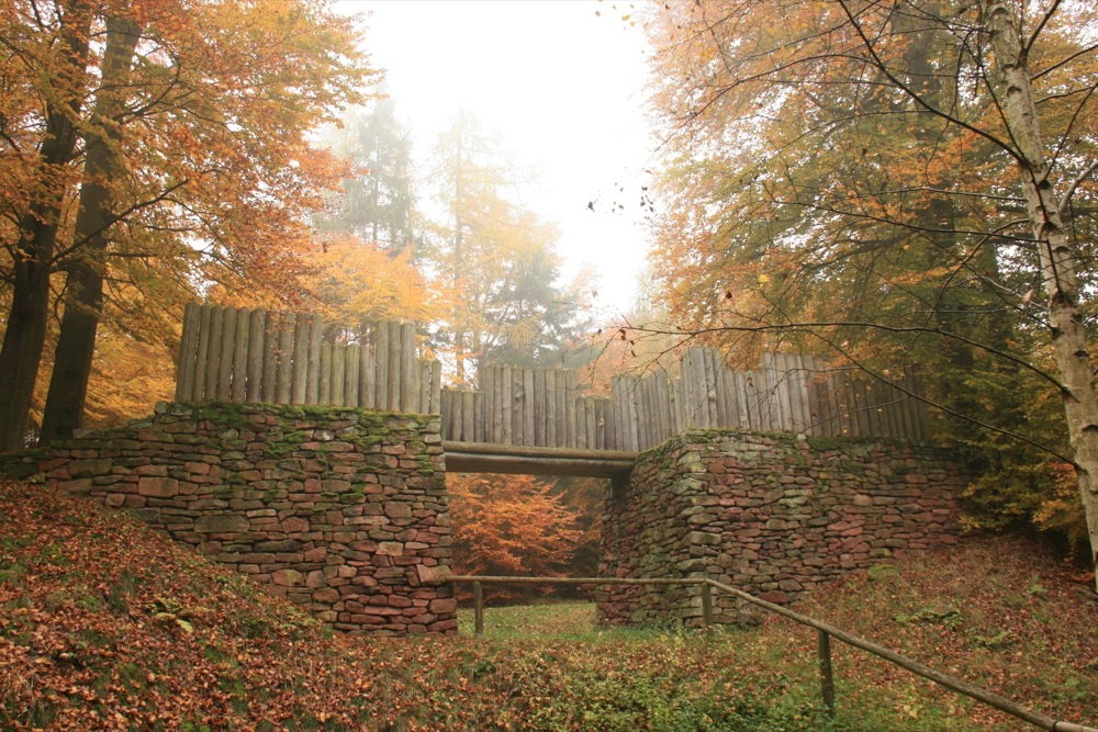
Nr. on the small map: 14 (Bürgstadt) Around 3200 BC, a significant Neolithic site with a wooden fort and rampart originated on the Bürgstadter Mountain. This first settlement period lasted around 250 years. During the Urnfield Period (1200-700 BC), the fort was secured again, this time with stone and soil walls. The population later settled […]
Jugendwanderweg (“Cultural and Youth Trail on the Nibelungensteig”)
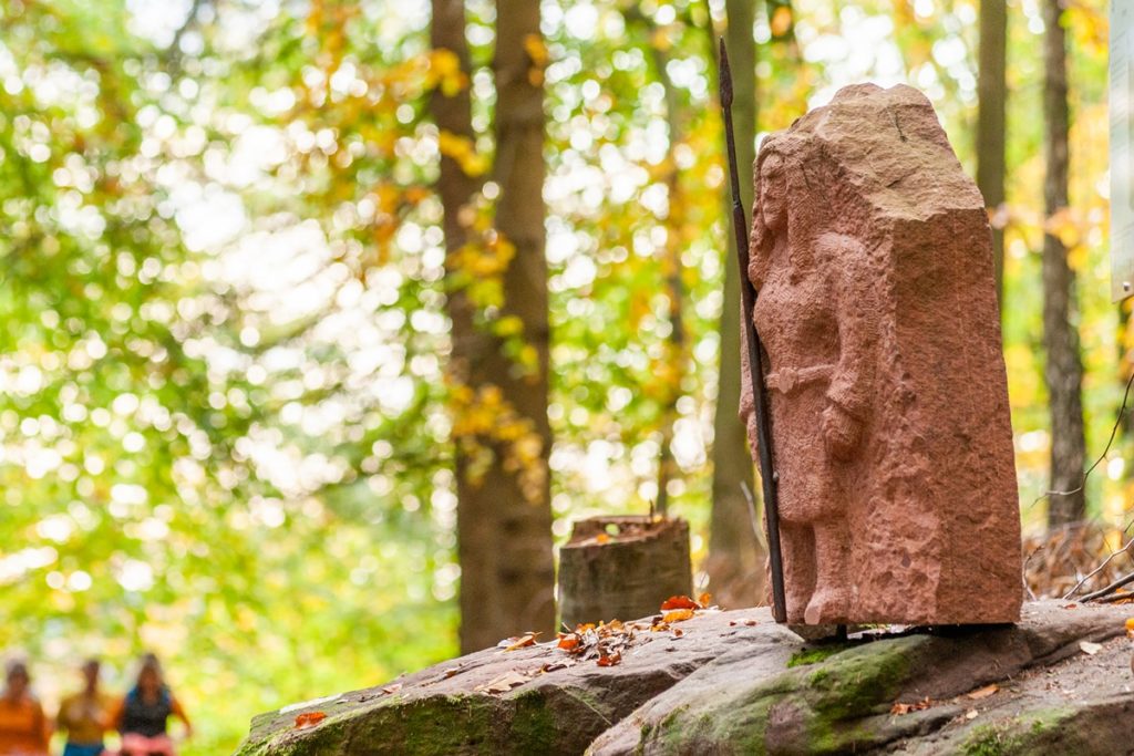
Nr. on the small map: 12 (Bürgstadt)About four of the ten kilometres of the Cultural and Youth Trail are part of the “quality hiking trail” Nibelungensteig. Those hiking on the long-distance trail do not only follow in the footsteps of history, the trail also features nine sculptures straight from the Song of the Nibelungs around Siegfried the […]