Kleinheubach - Princely Splendour
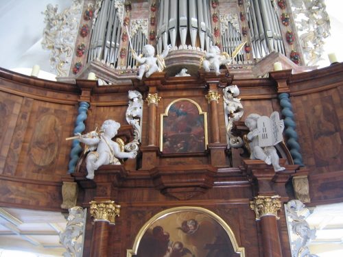
Kleinheubach is literally in the centre of Churfranken, surrounded by several wine towns. It has its very own and unique gems, like the Lutheran Baroque church with the organ made by a master named Dauphin.
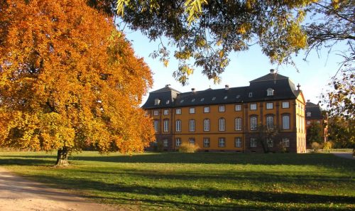
The baroque palace of the Prince zu Löwenstein was built in the French style, inspired by Versailles. Being mainly used as a conference hotel it is the venue of high-quality corporate events. The vinoteque of the vinery “Weingut Fürst Löwenstein” is found in the former princely stables.
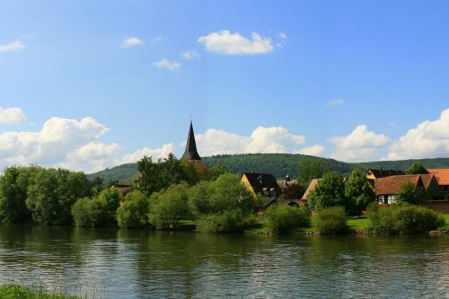
The alley “Fahrgasse”, next to the Lutheran church, takes you right to the romantic banks of the river Main with a magnificent view – right in the heart of Churfranken.
Do not forget your picnic basket!
Sights
The Historic Town Centre, a Street Quadrangle
Nr. on the small map: 1 (Kleinheubach)
The historic Town Centre of Kleinheubach is formed by a street quadrangle which at first sight appears to be a standardized and planned layout, but where each of the four streets actually emerged in different centuries.
The slightly bent Marktstraße forms the original part. It used to be part of the ancient Via Imperii (Imperial Road), which led from Frankfurt upstream towards the Miltenberger Main-Knie (river- “knee”-curve), forking into two paths, one leading to Nuremberg and the other to Augsburg. In its centre the church complex with the Lutheran Church (see #3) is located; right next to it is the Fahrgasse leading towards the Main-River (see #2).
Kleinheubach may have had many local lords, but has never belonged to the Archbishopric Mainz; the Reformation had been introduced by the Counts of Rieneck in 1556 and afterwards has remained in the village.
Around 1600, a new street was added at a right angle to the Marktstraße, when Count Georg III of Erbach was building his renaissance castle Georgenburg. It offered plots for new estates, formerly referred to as the Castle Square with some retained archways. Later, the classicist servants’ quarter was constructed on the opposite side giving the street its name ‘Baugasse’ (Construction alley).
Due to the construction of Georgenburg, the Via Imperii was slightly rerouted outside of Kleinheubach. This brought some benefits to the village, now being right next to the frequented road. The current Hauptstraße (Mainroad) has its origins there and has only been used for buildings after 1800.
The quadrangle was finally completed around 1835, when the Bachgasse was laid out. A well-conceived plan enabled similar, yet different sized houses for a growing number of families. In the centre of this street quadrangle, a remarkable site for different kinds of garden plots remained (see #5). The Hirschplatz (named after a former restaurant), located between the Hauptstraße and Baugasse, forms a traffic junction also leading to the palace (see #12) and the park (see #13).
Lutheran Church St. Martin inside the Fortified Church Yard
Nr. on the small map: 2 (Kleinheubach)
The area around St. Martin was the origin of Kleinheubach, because this fortified church was located close to the Main-River on higher ground and therefore not endangered by floods. The former enclosing wall is stunning but was only retained at the riverside; inside the church yard you can find some one-room storages. A smaller predecessing building, was built in 1455. Of this church the tower and a dedicatory Latin inscription with translation have been maintained. Three remarkable gothic murals at the entrance originate from the same era:
St. Martin with the beggar, St. Wendelin as a shepherd, each with a church illustration, symbols, and names of the four evangelists, the Veil of Veronica, and inside, the archangel Michael depicted with scales, weighing souls.
The Hercules spolia had once been part of the foundation of a Roman Jupiter-Giant-Pillar as the Castellum “Old Town” was not far away. The nave and both circular towers were being constructed between 1707 and 1710. In the chancel you see the altar with a nativity painting, above there is a balustrade with the organ and beside there is the pulpit in its unmodified condition. The organ builder Johann Christian Dauphin (1682-1730), who had newly arrived from Thuringia, built the organ in 1710, which was reconstructed in the baroque style in 2010. “Crowns of Death”, which were placed on caskets of unmarried people as part of a burial custom, are on display. Next to the entrance of the church yard, inside the church, and in the small garden behind, you find seven grave slabs originating from the 17th and 18th century five of which were once embedded in the church floor.
Opening hours:
May to October 09.00 am to 06.00 pm,
November to April on demand at the rectory, Tel. +49(0)9371-4248
Fahrgasse
Nr. on the small map: 3 (Kleinheubach)
Ferrymen would live in the Fahrgasse because at the end of the road, at the Main-River, the ferry was anchored, crossing over to Großheubach, from where the trade-route Eselsweg (Donkey Trail) crossed the Spessart connecting our region to (Bad) Orb. Ferry rights belonged to some families of Kleinheubach, assigned to them even before 1500. In 1974, the ferry service was discontinued due to a new bridge connecting Klein- and Großheubach; even though a last ferryman partly offered services afterwards for passengers only.
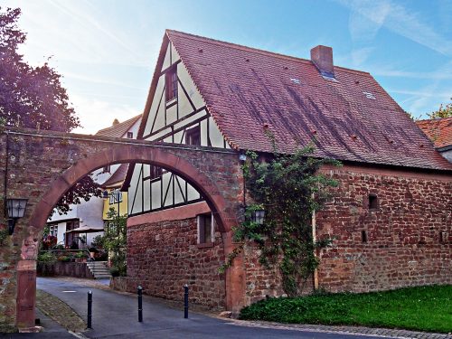
This well-maintained alley still shows classicistic door frames with dates around 1800 and some older half-timbered houses. The road ends at the so called Fahrtor (a gate), which shows impressive flood markings, proving some catastrophic floods of the otherwise ponderous Main-River. Meandering along the Main-River you find footpaths from which you can catch several glimpses of the Engelberg Abbey.
Historic Town Hall and DenkOrt Deportationen 1941 - 1944
Nr. on the small map: 4 (Kleinheubach)
Set on top of a predecessing building, the town hall was built in 1728 with a masoned ground floor supporting a half-timbered upper floor. The eaves side protrudes to the Marktstraße and provides a passage with two archways. The capstones of those archways show the earliest version of the local crest, a rearing lion on a rock, symbolic for Lowenstein.
Kleinheubach is part of the decentralized monument “DenkOrt Deportationen 1941 – 1944”. The municipal administration designed a dignified DenkOrt (“place of commemoration”) for the Jewish citizens, who had been deported from Kleinheubach.
Here you find the rolled up blanket made from sandstone, which commemorates the fate of the deportees; a second rolled up blanket is part of the monument in the Ringpark in Würzburg commemorating the deportees from Lower Franconia.
Information boards and a map present the history of the Jewish community in Kleinheubach and their institutions. This is also the place for the “Stolpersteine” (“stumbling stones”).
Town Wall and “Hecke” ("Hedge")
Nr. on the small map: 5 (Kleinheubach)
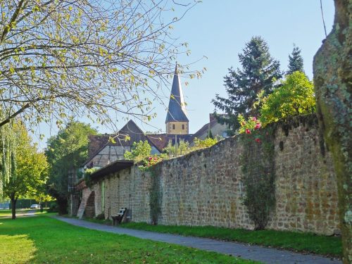
The oldest part of Kleinheubach, alongside the Marktstraße, was surrounded by a high wall where several parts still can be found at the longitudinal sides and the Rudenauer Creek. The gates at the upper and lower ends were demolished. The green center of the street quadrangle, the so called “Hecke” (hedge) is accessible by various walkways; i.e. from the Historic Town Hall. Here the town wall has been preserved in its entire length. Located in front of this wall was a wide hedge, more like rambling briars to prevent invasions. Later, smaller garden plots developed instead and have been cultivated until today.
Mikvah Kleinheubach
Nr. on the small map: 6 (Kleinheubach)
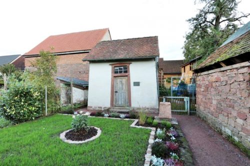
In 1837, the ritual bath in the basement of the synagogue was in pitiable condition: no lights, no heating facilities, wet and slippery stairs. The district physician’s report led to a shutdown by local authorities. The “Fischgässchen” (Fish Alley), next to the Rudenauer Creek became the new site and was in use up to 1926. In 1935 the site was sold to a non-Jewish civilian and fell into oblivion. Between 1991 and 1992 it was renovated and nowadays you can take a look around.
Local History Museum “Old Railway Station”
Nr. on the small map: 8 (Kleinheubach)
The local museum, run by the History and Local Traditions Association, is located inside the old railway station. You can admire an ancient cinerary urn from the Urnfield Period, Roman coins, and additionally, some last century’s most common durables.
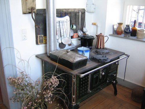
Relating to Kleinheubach, are an old kitchen stove, produced by former iron company Wetzler and some ceramic articles from the early days of the Scheurich Company. Kleinheubach is also proud of the chain of the “Mee-Kuh” (“Main River Cow” named for the sound it made), a former type of chain boats on the Main river. At that time a huge progress in transporting goods on the Main River.
The museum doesn’t have any regular opening hours, but you are welcome to visit it on request.
Sightseeing with Arno Bauer, chairman of the History and Local Traditions Association Kleinheubach
Tel. 09371-669 9164
Mobile 0162-7590 207
arnobauer51@web.de
Catholic Parish Church “Heiligste Dreifaltigkeit” (Holiest Trinity)
Nr. on the small map: 9 (Kleinheubach)
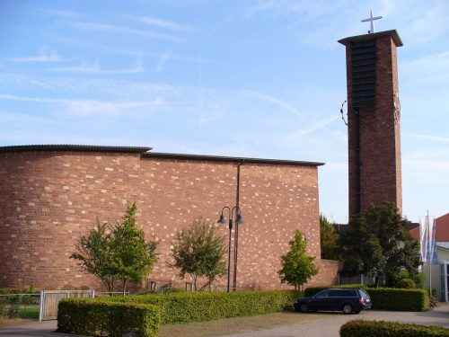
The Palace Chapel provided a sacred place for the princely family and their mostly Catholic servants. The number of Catholics increased after 1945, because of refugees and expellees so that the Catholic Parish Church “Heiligste Dreifaltigkeit” was built and inaugurated in 1954. It is a typical post-war ecclesiastical building by Hans Schädel (1910-1996), the apostolic and master builder of Wurzburg. The original altarpiece by Karl Clobes (1912-1996) which had symbolized the Holy Trinity was replaced by a crucifixion group by sculptor Hans Heffner (1888-1969) from Würzburg.
Hofgarten
Nr. on the small map: 10 (Kleinheubach)
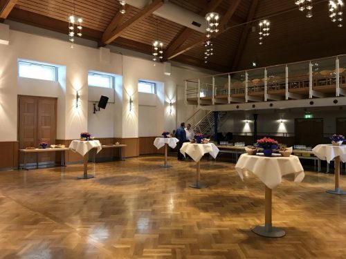
The Hofgarten in Kleinheubach was built in 1812 for the family of the Prince of Löwenstein and was used as a riding arena until 1930. After that the hall was given to the Red Cross and later to the gymnastic club as a storage facility and a gym.
After 1945 this room was converted into a theatre and a cinema. In 1947 the “Katholischer Kirchenbauverein” (“catholic club for the construction of a church”) bought the facility. it was planned to turn this building into a church.
After the club was disbanded in 1963 the building passed into the ownership of the catholic parish community.
From that time on the Hofgartensaal was used as a ballroom, for carnival revues and for municipal events like town hall meetings, senior citizens days and exhibitions. To keep it publicly accessible extensive renovation would have been necessary, so the parish community decided to sell it to the municipal administration. The town administration has been owner of the hall since 1st October 1990.
Rental:
Markt Kleinheubach
Friedenstr. 2
63924 Kleinheubach
Germany
Tel. +49(0)9371-971624
www.kleinheubach.de
Jews in Kleinheubach
Nr. on the small map: 11 (Kleinheubach)
A few Jewish citizens lived in Kleinheubach as early as the 14th century. A later congregation was founded in the second half of the 17th century and existed until 1942. The municipality had a synagogue, a new classicistic style building of 1808, at the end of the former “Judengasse” (Jews’ Alley), nowadays Gartenstraße (Garden Road) – a byroad of the Baugasse. Previous to the building of a synagogue, private residences served as prayer rooms. A school, inaugurated in 1911, with teachers’ quarters, a mikvah, and a cemetery bear witness to a former lively Jewish community.
Classicistic Kleinheubach
Between 1815 and 1835, Friedrich Karl Streiter (1780–1850), the princely constructional advisor, architect, and master builder created some exemplary monuments in the classicistic style. This stylistic resort to antique, strictly segmented designs, contrasts strongly with excessive baroque and dainty Rococo. This is rather apparent in numerous (parts of) buildings in Kleinheubach which originate from Streiter. Despite being rather cold and down-to-earth, the wide and high main staircase inside the palace easily blends in. The lengthy servants’ quarters were built between 1819 and 1825, and had several features.
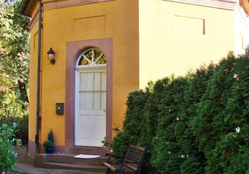
The entrances of two houses in the Fahrgasse, the palace pharmacy at the Hauptstraße, and the octagonal Schell’s house located at the side entrance to the park are classicistic. Representative for Friedrich Streiter are Egyptian style settings which were influenced by Napoleon’s Egyptian military campaign: In the palace gardens the so called ice cellar with a temple staffage and a sphinx; the entrance area of the synagogue, rather dominantly the mikvah, and also at the street front of the Hofgarten.
Princely Palace Löwenstein-Wertheim-Rosenberg
Nr. on the small map: 12 (Kleinheubach)
The palace of the princely family “Lowenstein-Wertheim-Rosenberg” in Kleinheubach is more than extraordinary. Laid out in late baroque style by architect Louis Remy de la Fosse (1659–1726) from Darmstadt, it was built by Johann Dientzenhofer (1663–1726) from Bamberg after 1723. Master builder Johann Jakob Rischer (1662–1755) from Mannheim was able to finish the entire palace ensemble later on in 1732. The median risalit of the three-wing building consists of the antechamber and the high marble hall; further up you find the balustrade and roof construction.
Up there monumental stone statues symbolize four continents; from the palace yard you see America and Europe. An alliance-coat-of-arms sits in-between, though symbols of Lowenstein-Wertheim were quite deliberately left out, showing only that of Hesse-Rheinfels, the wife of palace builder Dominikus Marquard (1690–1735). The antechamber is supported by pillars, the origin of an impressive classicistic stairway leading up to the marble hall. Its interior captivates with grey stucco marble, two high mirrors above fire places, numerous paintings, and stucco figurines. The ceiling fresco symbolizes the “Triumph of Truth” and shows the god of time who is revealing truths; an ambitious topic of the early family history. Inside the infinity coves below, individuals and allegories represent four continents. Europe relates to Emperor Karl VI (1685–1740), crowned in 1711, the princely Maximilian Carl of Lowenstein-Wertheim-Rochefort (1656–1718), Prince Eugen of Savoy, and other companions. Along the walls over-door and oval paintings of the Diana cycle are displayed with biblical topics and references to the family history besides grouped cherubs and medallions. The catholic palace chapel can be clearly recognized by almost fully retained crown glass windows of 1870, colored in the style of the Nazarenes by Eduard of Steinle and U. Becker, inside the right wing of said palace.
Palace Gardens
Nr. on the small map: 13 (Kleinheubach)
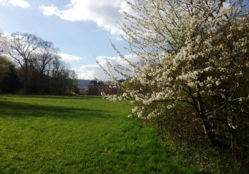
Formerly, a main courtyard with fences, a gate, and a sentry box surrounded the three wings of the palace and both dependences. Throughout the 19th century, this strictly centered alignment was rearranged. In front of the palace a sloped meadow with a new access was formed; however the entrance was relocated towards the village, facing the Hirschplatz. The accompanying colossal, red sandstone lions are works by sculptor Heinrich Philipp Sommer (1778–1827), Hanau. The park, resembling a landscaped garden, was laid out 1816-18, surrounds the palace and stretches towards Miltenberg.
Its meadows with generous sight lines and groups of partly exotic trees, mixed with the indigenous vegetation along the Main River banks, are appealing. During 2017-19, around 150 trees from all continents were planted and several flower and bee meadows were created. The trees carry on the tradition of the park. At the same time they are part of a trial in times of climate change, collecting data on which species will survive extreme weather escapades. The English Park is open to public and you can treat yourself with a longish walk; the neighboring vineyard estate, the immediate vicinity of the palace, and the park scenery are all part of the private residence.
Parkhof / Roman Fort "Altstadtkastell"
Nr. on the small map: 15 (Kleinheubach)
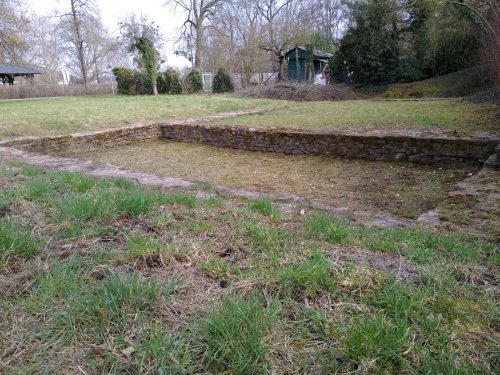
Near today’s Kneipp facility, next to the restaurant “Parkhof”, there used to be a Roman fort, hosting a cohort, consisting of 480 men, both cavalry and infantry. Only a few remains of the walls and the Roman bath are left and can be seen.
Jewish Cemetery
Nr. on the small map: 7 (Kleinheubach)
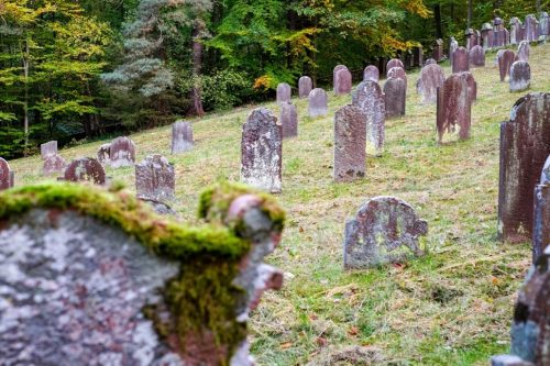
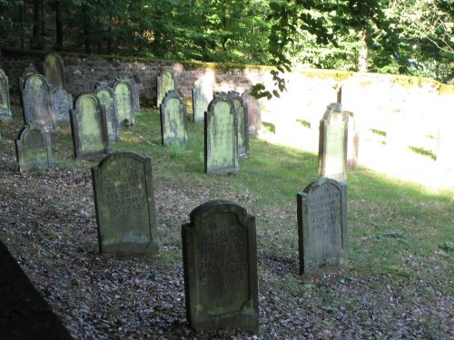
The Jewish Cemetery is in the forest to the north-west of Kleinheubach in the direction of Laudenbach. You can reach it on foot from a parking lot. Before the cemetery was created in 1730 the deceased Jews of Kleinheubach had been buried in Michelstadt. In the late 17th century and in the 18th century the deceased members of the Jewish communities in Erbach (in the Hessian part of the Odenwald), Laudenbach, Trennfurt and Wörth as well as Miltenberg were also put to rest on the cemetery in Kleinheubach.
Most of the tombstones are made of bunter sandstone and show Hebrew inscriptions. On the newer tombstones the name of the deceased has been written in Roman letters on the back of the stone.
The older and the newer part of the cemetery are at a right angle to each other and are protected as a monument and a conservation area.
The association „Jüdisches Leben in Unterfranken – Biografische Datenbank e.V.“ (link in German only) have not only collected the biographies of those Jews who fell victim to the Shoah, they also made a list list of those who once lived in Kleinheubach.
Parkhof / Altstadtkastell
Nr. on the small map: 15 (Kleinheubach)
Near today’s Kneipp facility, next to the restaurant “Parkhof”, there used to be a Roman fort, hosting a cohort, consisting of 480 men, both cavalry and infantry. Only a few remains of the walls and the Roman bath are left and can be seen.
History
Kleinheubach first was mentioned in 877 when King Louis III signed a certificate in “Heydebah” (Kleinheubach). Nevertheless, it has been verified by numerous grave findings that the local subdistrict had already been populated during the Neolithic Age.
Historic Roman Fort and Wallhausen
Historically certified, the Roman fort or Castellum “Old Town” was located at the park exit towards Miltenberg, used by a cohort of Roman soldiers, serving as the corner bastion of the Limes (border of the Roman Empire), located at a passage between the so called wet and dry Limes. After the attack of the Alemanni, approximately around 260 AD, the Franconians set out from the Rhine and conquered the Main Valley.
On top of the ruins of the former Roman Castellum “Old Town”, a city named Wallhausen was founded, but vanished again around 1247, during fights between the Archbishop of Mainz, the Count Palatine of the Rhine, and the Counts of Rieneck for supremacy . Most inhabitants moved to Miltenberg seeking shelter behind firm city walls and beneath the castle.
Kleinheubach, being neighbour to Wallhausen, had a controlling situation in the Main Valley, along the historic escort road Nuremberg-Frankfurt and the important Main-River-Ford, securing the crossing of the Main-River towards the so-called Eselsweg (Donkey trail), a trade route mainly for salt.
Kleinheubach was crownland and administered by the Count Palatine of the Rhine who enfeoffed the Counts of Rieneck with this land. Furthermore, it was seat of criminal, political, and disciplinary tribunals. It also was the center for the lower Cents (Cent being a regional term for a judicial district). After the fall of Wallhausen in 1247, all rights of the Mother Church of Wallhausen were transferred to Kleinheubach and, by receiving these privileges, the economic and political ascent commenced.
Rule of the Counts of Erbach
In 1455 the old private Rieneck chapel was replaced by a new church building. Governed by the Counts of Erbach, who later inherited the titles of feudal lords, the population kept growing and a further modification and annex to the church became necessary between 1706 and 1710. In medieval times, Kleinheubach flourished while being ruled by the Counts of Erbach, who set up their residence, the Georgenburg, right there; sadly it only lasted until the 30-years-war which brought misery and death as well as the plague and witch craze, all decimating the population so excessively that partly the village was completely vacant. The worst incident during those years of war was the fire of April 24th, 1627, when the city hall and 40 residences were burnt down by looting soldiers, nearly turning Kleinheubach into wasteland.
Reformation and Building of the Lutheran Church St. Martin
In 1556 the Reformation was introduced to Kleinheubach. The current church, St. Martin, which was being renovated between 1974 and 1976, became the church of the Lutheran congregation.
Building the Baroque Palace
The dynasty of Lowenstein acquired the sovereignty of Kleinheubach from the Counts of Erbach in 1721. Dominikus Marquard, Count of Lowenstein-Wertheim, commissioned the builders Remy de la Fosse, a Versailles architect, and Johann Dientzenhofer, with the construction of a palace at the exact location of former Georgenburg. The building was completed in 1732, and has since then been the main residence of the Counts of Lowenstein-Wertheim-Rosenberg. Towards the end of WW II, the palace was damaged and plundered severely.
After 1950 the palace was used as a conference center and educational establishment of the German Post. Meanwhile it is a convention center and closed to public. Since 2004, the palace with its dependences and spacious park has been part of the non-profit foundation ‘Count of Lowenstein’. Alongside you can find the vineyard estate ‘Count Lowenstein’ with a high end vine tasting shop.
Population
After the Liberation Wars, the district Kleinheubach first became part of Baden but in 1816 was allocated to Bavaria. By integrating the expellees after 1945, the population doubled and today totals at around 3,700 inhabitants.

