Search

Miltenberg

Miltenberg not only delights with a medieval old city centre filled with half-timbered houses, romantic alleyways and hidden corners. It is also a place of vibrant urban culture and youthful Middle Ages.

Miltenberg – Youthful Middle Ages

Miltenberg not only delights with a medieval old city centre filled with half-timbered houses, romantic alleyways and hidden corners. It is also a place of vibrant urban culture and youthful Middle Ages.

Discover Germany’s oldest inn for nobility, the “Gasthaus zum Riesen” (“Giant’s Inn”) as well as the famous “Schnatterloch” which forms part of the old market square. This ensemble consisting of the market fountain and magnificent half-timbered houses is a highlight of romantic, historic townscapes. It is one of the most photographed places in Germany.

The award-winning Museum Stadt Miltenberg, counted among the most beautiful museums in Bavaria, presents the daily life of past centuries as well as art, history and our region. A fascinating interaction of ancient ikons and contemporary art can be seen within the historic castle walls of the Mildenburg, where you will find the Museum Burg Miltenberg overlooking the town.

We recommend Miltenberg as the starting point for your activities in Odenwald and Spessart. Discover the countless opportunities: No matter, if you want to play golf on the amazing courses around Miltenberg, if you want to go shopping or walking, go on bicycle or mountainbike tours, have a swim, play tennis, go horse-riding or visit museums or vintners – there is something for everyone!

All year long you can choose between many cultural events, be it guided tours, cabarets, concerts, theatre or kleinkunst, exhibitions, readings or presentations – you can find everything in our online event calendar. Regional festivals like the MainFest, the Michaelismesse (St. Michael’s Fair), the Miltenberger Weinherbst or Christmas markets add to our varied offer of spare time activities.

Miltenberg and its incorporated villages

Would you like to relax, enjoy some tranquility or escape daily routine?

Then our villages resting on top of the pictorial rolling hills of the Odenwald, only a few kilometres outside of Miltenberg will feel just right.

Mainbullau

Mainbullau is the ideal place for sky divers, glider pilots and hikers. Discover the "Heunesäulen" ("giants' columns") at a short distance to the street to Mainbullau.

Wenschdorf & Monbrunn

Wenschdorf anf Monbrunn are on the top of the mountain just south of Miltenberg. They are great starting places for hikes on the heights of the Odenwald.

Schippach & Berndiel

Schippach and Berndiel may be the most tranquil ones of our villages. They consist of several individual farms.

Breitendiel

Breitendiel is the only incorporated village not to be found on top of the Odenwald mountains. It is located next to the bike path to Amorbach in the valley of the small river Mud (pronounced "mood"), a tributary to the Main river.

Sehenswürdigkeiten

"Schwarzviertel" ("Black Quarter")

Nr. on the small map: 8 (Miltenberg)
The “Black Quarter” is the oldest part of Miltenberg with a lot of beautiful half-timbered houses, located between the Schwertfeger Gate and the Market Square. The Greinberg mountain in the south casts its shadow onto the “Black Quarter”, so that in winter the sun barely reaches the ground; hence its name. The oldest remaining half-timbered house of Miltenberg, however, can be admired in the pedestrian area, Hauptstraße 136, and was built around 1339. By mistake, the year of construction was inscribed with 1333.

Mikvah

Nr. on the small map: 9 (Miltenberg)

You find a Mikvah in the center of the “Black Quarter”, in the Löwengasse. It was a bath used at specific occasions for the purpose of ritual immersion in Judaism and was in use until the beginning of the 20th century. The four-storey half-timbered house is now privately owned and was renovated in 2003.

Bann Haus

Nr. on the small map: 10 (Miltenberg)

From the 13th century until 1780, the former Bann House used to be a customs office for Mainz. In its courtyard there are remains of the oldest town wall of Miltenberg. Siege projectiles, so called trebuchet stones, are decorating the retaining wall. From the 19th to the beginning of the 20th century, a new building in the same spot was used as town prison.

Former Superior Bailiwick (Oberamt „Adelshof“)

Nr. on the small map: 11 (Miltenberg)       

The former Superior Bailiwick was originally an aristocratic court and, the way it presents itself today, dates back to the family ‘Lords of Fechenbach’, approximately in 1679. After 1730, it became bailiwick of Mainz, later an official building with different designations until 1964. A medieval tower (Stumpfturm) being part of the first town wall to the west was constantly guarded by two men as statutory by a watch and fire regulation.

First Synagogue

Nr. on the small map: 12 (Miltenberg)

Around 1290, the First Synagogue of Miltenberg was built. It is one of the oldest sacred Jewish buildings of Europe, retained in its original masonry. Inside the Museum Stadt Miltenberg, you can look at the only salvaged interior fitting: The pediment of the Torah. Sadly, the synagogue is not open to public, as it was sold to a brewery in 1877 by the Jewish Community.

Tip: A significant collection of Judaica is on display in the Museum Stadt Miltenberg.

Parish Church „St. James the Great“

Nr. on the small map: 13 (Miltenberg)

The Church “St. James the Great” had already existed since the early days of Miltenberg in the 13th century but has frequently been reconstructed and enlarged. Its last fundamental interior renovation, where the inside of the church was redesigned, concluded in 2004. Still present are, e.g. the 14th century pillars at the central nave, the Three Wise Men from around 1400, the so-called Backoffen-Cross from around 1500, and the alabaster altar piece from 1624, as well as the pulpit of Zacharias Juncker from 1635.

The depiction of Mary, originally in the pilgrimage chapel “Maria uff den Staffeln” (“St. Mary on the Stairs”) which was demolished in 1825, is singled out in a side chapel. The classicistic towers of 1830 crucially determine the town’s image.

Staffelbrunserbrunnen ("Stair-Piddlers’ Well")

Nr. on the small map: 14 (Miltenberg)

A lot of towns and communities have mocking or nicknames which nowadays are used mainly during Carnival season. Citizens of Miltenberg are the “Staffelbrunser” (Stair Piddlers: “brunsen” being the local dialect word for peeing). The “Staffelbrunserbrunnen” was made in reference of this mocking name. 

Even though there are lots of legends trying to explain the nickname, the most reasonable explanation is that those fetching water from the “Stair Well” (# 21) were called the Stair Pitchers. 

At some point this nickname was used for all citizens of Miltenberg and, and with the similarity of the words “Brunsen” (peeing) and “Brunnen” (well), spoofed into Stair Piddlers.

The well was created by Helmut Kunkel, an Aschaffenburg sculptor, by order of the Tourism Board Miltenberg, which merged a bit later into “MCity Trade and Tourism Board Miltenberg”. The statues represent different characters: the Tiny, the Tall and the Show-Off.

Market Square with Market Fountain and the „Schnatterloch“

Nr. on the small map: 15 (Miltenberg)

The heart of town is, without doubt, the Market Square with its Market Fountain. Numerous magnificent half-timbered houses, the Schnatterloch Tower, the renaissance archway leading to the Castle, and the renaissance fountain (1583) by Michael Junker (see Bürgstadt # 9) blend into a coherent picture, which is famed as one of the most photographed images of Germany. 

House Clausius (Hotel Schmuckkästchen) with its oriel, also known by various other names, is particularly flashy. The probably most beautiful houses were built between the 16th and early 17th century and still present themselves proudly the day today. Also from the times after the Thirty Years War, there are still some half-timbered houses present and complete the setting.

Museum Burg Miltenberg and Mildenburg Castle

Nr. on the small map: 16 (Miltenberg)

Around 1150 the Mildenburg Castle was built by order of the Staufer King Conrad III. The castle keep and the castle wall date back to this time.

Around 1200 the castle became property of the Archbishop of Mainz who used it as an office building for his bailiff. Below the castle the settlement Miltenberg grew fast.

The castle’s current appearance dates back to the 16th century, when it was partly destroyed in the Margrave War (1552) and then reconstructed with the stair tower as a new feature. The bailiff moved to the town around 1730 and the building fell into decay. Ownership of the castle changed repeatedly during the 19th and 20th centuries. The respective owners modernized parts of the complex and added other parts. 

In 1979 the administration of Miltenberg bought the building  which by then was in a very pitiable state. Following extensive renovations the Mildenburg Castle is now open for public. 

The keep offers stunning view into the river Main valley and onto the town.

The castle has been used as Museum Burg Miltenberg since the renovations were completed in 2011 and you can take a closer look at a fascinating interaction of ancient icons (16th to 19th century from Russian and Greek provenance) and contemporary art. The pieces are from the 20th and 21st century, e.g. by artists like Barlach, Beuys, Fräger, Lange, Lehnen, Morgner, Polke, Stötzer, Stoltz, Triegel, and Willikens. Just like the view from the castle’s windows offer a glance beyond the boundaries of the walls on the endless panorama of the Main River, the artworks offer a glance beyond the boundaries of our life and world. The artists’ spiritual intentions to cross frontiers inspire the visitors to open their horizons and envision this particular dimension of the museum.

Opening Hours:
16th March to 1st November: Tue – Sun 11:00 – 17:00 h
2nd November to 15th March: Winter break

Museum Burg Miltenberg
63897 Miltenberg
Germany
Tel.: +49(0)9371-668504

verwaltung@museen-miltenberg.de
www.museum-miltenberg.de

Guided tours can be offered outside opening hours as well

Tip: Burglandschaft
Numerous castles, palaces and ruins, as well as fortified churches, circular ramparts and fortified towns around Miltenberg just wait to be explored. 

Museum Stadt Miltenberg

Nr. on the small map: 18 (Miltenberg)

The main building was built in 1541 by the Mainz Bailiff Bernhard von Hardheim on an older building’s footing. From 1625 on the house was used as the seat of the Mainz Electorate’s administration. The adjacent former Latin school, and a renaissance style garden offering a delightful view of the town are also part of the museum.

It now houses the museum of the town of Miltenberg (Museum Stadt Miltenberg) with a sumptuous, collection of transregional importance including many precious objects.

Architectural features of the museum are pointed out to visitors along the way through the buildings. Regular events and special exhibitions make the visit even more worthwhile.

The museum was awarded the Bavarian Museum Award and the Advancement Award of Lower Franconia.

Opening hours:
16th March to 30th September: Tue – Sun 10:00-17:00 h
1st October to 1st November: Tue – Thu 10:00 – 17:00 h
Fri – Sun 10:00 – 14:00 h
2nd November to 14th January: Wed – Sun 11:00-16:00 h
15th January to 15th March: Winter break

Museum Stadt Miltenberg
Hauptstr. 169-175
63897 Miltenberg
Tel.: +49(0)9371-668504

verwaltung@museen-miltenberg.de
www.museum-miltenberg.de

Guided tours are also available outside the opening hours and groups are welcome to book a museum workshop (also available for adults).

Composer Joseph Martin Kraus and the Baroque House at the Market Square

Nr. on the small map: 19 (Miltenberg)

Builder Johann Martin Schmidt constructed this house at the Market Square in 1750 of red bunter sandstone as his private residence. His grandson, the composer and later royal Swedish court music director Joseph Martin Kraus who is nicknamed „Odenwälder Mozart“ was born in this house in 1756. Kraus grew up in Amorbach, Osterburken and Buchen, enjoying an extensive education from the beginning.

Despite his love for music he first studied law, and went to Stockholm in 1778 . At that time, Kraus already suffered from impaired health. Until he was appointed court music director by Gustav III, having performed his opera „Proserpin“, Kraus had lived through some bitterly poor years. He died at the peak of his career in 1792, and was laid to rest on the peninsula Tivoli in the north of Stockholm. Engraved in his tombstone you find: “Here rest the worldly remains of Kraus – his divine talent lives inside his music.” His numerous works include operas, stage and ballet music, arias, ballads, cantatas, symphonies, and chamber music pieces. The statue in front of the house was donated in 2006 by the Tourist Board Miltenberg as a monument for Kraus’ 250th birthday.

Tip: You can purchase CDs with a selection of Kraus’ music at the Museum Stadt Miltenberg or at the Tourist Information at the Engelplatz.

New Synagogue

Nr. on the small map: currently none (Miltenberg)

Miltenberg probably had a Jewish community from the very beginning. The first synagogue of Miltenberg was built in the late 13th century. After a long history of many ups and downs the now dilapidated building was sold to the neighbouring brewery (“Kalt-Loch-Brauerei”) in 1877. The brewer renovated and repaired it and converted it to his fermenting cellar.

Thanks to nation-wide collections and some very generous donations, among others from Jews who came from Miltenberg and had made a fortune abroad (first of all William Klingenstein) the town’s master mason Ludwig Frosch could be assigned to draft the first blueprints of a new synagogue in 1903. In late August 1904 the synagogue was inaugurated in “a festivity, held, not only by the Jews but by the whole town with unfeigned joy”, as then mayor and chronicler Jakob Josef Schirmer wrote.

In 1938 the Nazis destroyed especially the eastern part of the synagogue with the sacred spaces. Afterwards the house was reconstructed as a residential building. Today only some small elements remind those who know of the house’s history of its previous exterior (arches over the windows, an empty badge over the door but most of all the foundation stone).

Due to the destruction in the Third Reich, we have to rely on old photographs if we want to know what it originally looked like. In the register of monuments the description of the “New Synagogue” (monument D-6-76-139-293) is rather brief: “Former synagogue, two-storey building of bunter ashlars with a mansard roof and an elevated median avant-corps with a pyramid roof, historicist, 1904 (domed sacred space destroyed 1938 and reconstructed for residential use)”

Historic Town Hall

Nr. on the small map: 20 (Miltenberg)
The Historic Town Hall was first mentioned in 1379 as the weighing house. It was additionally used as dance and council hall (hall on the upper level), warehouse, and shopping mall (ground floor) where travelling merchants had to display their goods for sale. Between 1979 -1983, the building was renovated. Nowadays it can be booked for all kinds of events. Markings on the outer façade give evidence of former flood levels.

Staffelbrunnen (Stair Well)

Nr. on the small map: 21 (Miltenberg)
Up to 1897, numerous wells were the only water supply for the town. The Stair Well, which had been built around 1600 was excavated again in 1985 when the pedestrian area was established. Its name stems from stairways leading to the well (“Staffeln” dialect for “Stufen” = “Stairs / Steps”)

Apothecary Museum

Nr. on the small map: 22 (Miltenberg)

The first pharmacy of the region, at that time belonging to the electorate of Mainz, was founded in Miltenberg in 1514. Even Aschaffenburg did not have a pharmacy, which indicates the importance of Miltenberg.

In the early 18th century the building was renewed and reconstructed in the baroque style.

The pharmacy was closed in 2016 after more than 500 years of continuous business. Since spring 2021 the building is hosting a private apothecary museum, presenting the history of pharmacy and medicine since the 16th century. In the Fischergasse behind the building the old garden with medicinal herbs can be found.

Apothekenmuseum Miltenberg
Hauptstraße 116
63897 Miltenberg

info@apothekenmuseum-miltenberg.de 
www.apothekenmuseum-miltenberg.de

Inn "Zum Riesen" ("The Giant")

Nr. on the small map: 23 (Miltenberg)

In 1411, the tavern Zum Riesen was first officially mentioned. The present building dates back to 1590. It is considered the oldest inn of Germany and besides is proud to be the oldest royal inn of Germany. Since the innkeeper was not able to survive on noble guests only, the inscription on the house also invites citizens and farmers to step in.

Tip: The Faust Brewery brews one kind of beer to be served at the tavern only. The Riesen-Spezial can be tasted in-house.

Town Wall and “Witch Huts”

Nr. on the small map: 24 (Miltenberg)
Along the outer eastern side of the old town wall, you find remnants of old “witch huts” where in former times alleged “witches” and “sorcerers” were imprisoned. Up to 1630, witchcraft trials were carried out.

Older Jewish Cemetery

Nr. on the small map: 25 (Miltenberg)

You find the Older Jewish Cemetery between the historic city wall and the Burgweg, beyond the former moat. It commemorates the Jewish citizens who once developed a rich cultural and commercial life in town.

The association “Jüdisches Leben in Unterfranken – Biografische Datenbank e.V.” have not only collected the biographies of those Jews who fell victim to the Shoah, they also made a list of those buried on the Older Jewish Cemetery in Miltenberg – at least as far as the inscriptions are still legible.

Tip: You can buy a small guidebook “Jewish Miltenberg” at the Tourist Information for € 2.50.

Town Park (Arboretum)

Nr. on the small map: 26 (Miltenberg)
At the end of the 19th century, the Town Park of Miltenberg was laid out by Gustav Jakob, a wealthy citizen of Miltenberg, resembling an English Park and arboretum. Today the little park has almost 150 different species of trees and bushes and is not only a precious hideaway for relaxing but also for exploring – for example the wooden marble run. 

Lutheran Church "John the Apostle"

Nr. on the small map: 27 (Miltenberg)
The Lutheran Church was built in 1897 and, because of its architecture and choice of material, well worth a visit. The Statue of Christ at the outside of the tower is a copy of the statue inside the Copenhagen Cathedral by Bertel Thorvaldsen. Do not miss the colorful stained-glass windows with illustrations from the bible. A small guide is on display inside of the church.

Main River Bridge

Nr. on the small map: 28 (Miltenberg)

The passage across the Main River near Miltenberg has already been very important during the Middle Ages. Initially, ferries crossed from the Schwertfeger Tor, later also from the Ankergasse. Between 1898 – 1900, the first bridge was built, with the imposing bridge tower remaining until today. The bridge itself was blown up during the last days of the war in 1945; the reconstructed bridge was inaugurated in 1950.

Tourist Information in the Town Hall at the Engelplatz and Monument "DenkOrt Deportationen 1941 - 1944"

Nr. on the small map: 29 (Miltenberg)

The Engelplatz (Angel Square) got its name from the earlier hotel “Zum Engel” which was the first utilization of our present Town Hall. Between then and now the building has also successively been used for different school types.

The team of the Tourist Information is looking forward to meeting you and will gladly help with all requests, recommend the customized guided tours, accommodations, events or excursions, and of course with everything else your heart desires.

Miltenberg is part of the decentralized monument “DenkOrt Deportationen 1941 – 1944”. It consists of suitcases, backpacks, rolled-up blankets and other pieces of luggage, made of stone, wood or metal and representing the very few belongings people could take with them, when they were deported from Würzburg to various concentration camps. 

One specimen of each piece of luggage is in Würzburg and its identical counterpart is in the town from where the Jewish citizens were hauled off. 

Previous slide
Next slide

Franciscan Monastery

Nr. on the small map: 30 (Miltenberg)
The Franciscans, having already been present in town since 1630, initially lived in the hospital. Due to the Thirty Years War, the construction of the monastery was delayed. Therefore, the construction of the convent started in 1660, the church construction in 1667, realizing designs of the court architect of Mainz and Würzburg, Antonio Petrini. The main portal, donated by Archbishop Johann Philipp of Schönborn and the baroque interior design of the church are remarkable.

A family of Miltenberg donated the sculpture of St. Francis on the southwestern corner of the church in 2022. 

Klostergarten des Franziskanerklosters in Miltenberg

Old Archiepiscopal Tithe House ("Hartigsbau")

Nr. on the small map: 31 (Miltenberg)

The Old Archiepiscopal Tithe House received its name “Hartigsbau” honoring its owner in the 19th century. Beforehand, it had been the administrative center of the chapter of Mainz, designed in late gothic style, collecting the tithe, particularly through wine. The main building with the stepped gable dates to 1488/89.

Today the municipal music school and the community college have rooms inside.

Civil Settlement (Vicus) of the Roman Fort Numerus

Nr. auf dem Plänchen: 32 (Miltenberg)

In 1998, during construction works at house Maria Regina, a craftsmen’s site of a civil settlement was excavated. It had been part of the Roman Fort Numerus, situated about 300 m east (linear) between the Mittel- and Berufsschule. A melting pit, two pottery kilns, and remains of three wooden buildings were found. The Caritas as homeowner facilitated an exhibition next to the dining hall: a preserved pottery kiln with added information about the Roman era in Miltenberg.

Take a look at this Roman treasure (ca. 160-260 AD) during opening hours.

Tip: Finds from the Fort Numerus can be seen in the Museum Stadt Miltenberg and in the Museum Bürgstadt.

Würzburg Gate

Nr. on the small map: 33 (Miltenberg)
The Würzburg Gate (or Würzburg Tower – 32 m / 105 ft tall) was, like the Mainz Gate, first mentioned in 1379. It was the utmost outer borderline of the eastern suburb. Up to the 18th century, two watchmen were responsible to grant entry, collect tolls, guard the prison and warn in case of fire.

Tower "Zuckmantelturm"

Nr. on the small map: 34 (Miltenberg)
The “Zuckmantelturm” was erected in the middle/end of the 14th century and rebuilt several times. Its location and architectural design suggest it was a cornerstone guarding the south eastern town boundary. Here the town was extremely vulnerable.

Stolpersteine (Stumbling Stones)

Gunter Demnig laid the first nine “Stolpersteine” (“stumbling stones”) in Miltenberg in May 2016, by the instigation of the Initiative “Miltenberger Stolpersteine – GEGEN DAS VERGESSEN” (“Miltenberger Stolpersteine – FIGHT OBLIVION”). Meanwhile 44 “Stolpersteine” have been laid, commemorating 44 people who were either murdered by Nazis or driven to their deaths. Detailed information on “Stolpersteine” in Miltenberg can be looked up on this page

Saint Lawrence's Chapel

Nr. on the small map: 4 (Miltenberg)

First mentioned in 1380, St. Lawrence’s Chapel, a historic gem, is located at the outskirts of Miltenberg. The choir dates back to 1456, the nave was extended in 1594. The late gothic winged altarpiece from 1509, the frescos in the choir, the stone statue of St. Lawrence right from the outset, the statue “Mary and the Child”, and the whittled epitaph for Hans Ruppert from 1597, are considered precious jewels.

In 1826, the baroque organ was relocated from the demolished chapel “Maria uff den Staffeln” (“Saint Mary on the stairs”).
The chapel is surrounded by a small cemetery. The tombstones document the remarkable expertise of the stonemasons throughout the centuries. The epitaph of Jost Virnhaber, the innkeeper of the Riesen, at the southern wall of the choir, is especially remarkable.

Tip: You can view the chapel with a previously arranged appointment. Call the Catholic Ministry at least one week in advance.

You can reach the ministry as follows:
Monday, Wednesday and Friday 8:00 – 12:00 h,
Thursday 16:00 – 18:00 h

Tel. +49(0)9371-2330.
pfarrei.miltenberg@bistum-wuerzburg.de 

Mainz Gate

Nr. on the small map: 5 (Miltenberg)
The Mainz Gate, sometimes called Mainz Tower or Spire, was first mentioned in 1379, as the utmost western borderline of the town. The distance between both towers (Mainz Gate to the west and Würzburg Gate to the east) amounted to about 2 km (1.2 m). The crest of Archbishop Johann of Nassau above the archway (original piece in the Museum Stadt Miltenberg), is reminiscent of the modifications  carried out around 1400.

Sachsengrab (Saxons' Grave)

Nr. on the small map: 6 (Miltenberg)
On April 12th, 1814, 62 soldiers of the light infantry unit “Banner der freiwilligen Sachsen” (a kind of Freikorps from Saxony) and three local ferrymen died when the overloaded ferry capsized. Count Emich Carl of Leiningen donated the memorial. (His wife was a Princess Saxony-Coburg-Saalfeld)

Schwertfegertor (Sword Cutler's Gate)

Nr. on the small map: 7 (Miltenberg)
The Schwertfeger Gate was the far end of the inner western suburb and was probably named after a sword cutler who worked there.

Heunesäulen ("Giants' Pillars")

Nr. on the small map: 1 (Miltenberg)
The Romans already exploited red bunter sandstone needed for their forts around Miltenberg. The so-called “Heunesäulen” bear witness of the “Red-Sandstone-processing” during the (later) Middle Ages. They were carved from a block field at the Bullauer Berg, located between Miltenberg and Mainbullau. The five stately bunter-sandstone-pillars are 7 m (23 ft) long and have a diameter of 1.10 m (3.6 ft).

It is assumed that these pillars were meant to be used in the Mainz Cathedral which was burnt down and destroyed in 1009. Yet, they may possibly be even older, of Roman origin. Why the pillars were never shipped is unknown.

Besides those specimens still present on site, you find further pillars of Miltenberg at the archeological state collection of Munich, inside the German National Museum of Nuremberg and on the Mainz Cathedral Square.

One pillar was set up next to the mooring position of the sightseeing boats in Miltenberg, near the bus parking lot “Pfarrkirche”. Who carved them, when, and for which exact reason, might allow a lot of interpretation, but proceeds to be an unsolved mystery.

Roman Fort „Cohort“ Miltenberg / "Old Town"

Nr. on the small map: 2 (Miltenberg)
Around 159/169 AD, the Romans extended their borderline, the so-called Limes, all the way to the “Miltenberg Mainknie” (Main River Knee) and here they secured the passage from a river to a land boundary with two forts. Almost 500 soldiers, infantry as well as cavalry, protected the fort Cohort, west of today’s town. Being pushed by the Teutons, the Romans pulled their troops back towards the Rhine River around 260 AD.

On top of the remains of said fort, the town Wallhausen, predecessor of Miltenberg, was laid out.

Tip: Findings of this fort and of the town Wallhausen can be admired inside the “Museum Stadt Miltenberg”, located at the Market Square

Ringfort on Top of the Mountain „Greinberg“

Nr. on the small map: 3 (Miltenberg)

The Greinberg dominates the Main Valley at Miltenberg. Findings from the Bronze Age confirm that the area was inhabited between 1700 -1200 BC.

The ringfort has two ramparts around the mountain’s brow (highest elevation 452 m / 494 yd above sea level). The outer rampart covers an area of about 20 ha (50 acres). When the Romans arrived around 159/169 AD the site had already been deserted.

The Romans worshipped their god Mercury at the slopes of the Greinberg and built a temple for him in the center of the ringfort.

Evidence of worshipping Mercury are on display in the Museum Stadt Miltenberg.

Blockfield ("Felsenmeer") and Circular Hiking Trail "3 im Wald" ("3 in the Forest")

Nr. on the small map: 17 (Miltenberg)
“Felsenmeer”
The spectacular natural monument “Felsenmeer” is situated above the Schnatterloch and is a product of geological processes which started approximately 245 m years ago. At that time, the Odenwald was part of a semi-desert-like landscape. River sediments fossilizing over millions of years formed the red bunter sandstone.

During the Tertiary, about 50 m years ago, we experienced a subtropical climate, leading to in-depth weathering of the surface area. Approximately 2.6 m years ago, the Ice Age started. The Odenwald of those days was located in the permafrost region, comparable to the tundra of today, where megaloceros, woolly rhinoceros and mammoth roamed. In summer, the ground only thawed as deep as one meter (3.2 ft) or even less. The weathered material then began to slide in slope areas. Caused by precipitations during warmer periods, the finer material was washed away and the bigger rocks remained. This is how the blockfields of the Odenwald emerged which in fact are of different ages though all formed by similar processes.

“3 im Wald” (“3 in the Forest”)
The Natural Barefoot Path consists of two legs (each about 200 m / 219 yd long). Starting at the Schnatterloch bridge, the path will take you to the rock “Ottostein”. The path is a pristine forest trail with small gravel, cones, leaves, soil, and all other features nature has to offer along trails and paths. Please mind each step and be cautious wherever you go!
Grant your feet some rest after having covered half of the trail, spend some time at the picnic area and try out your dexterity at the wooden play equipment. When rested, proceed on the second leg and you will reach the spectacular natural monument Felsenmeer (lit. „sea of rocks“, a blockfield), a wonderful location dating back to previous Ice Ages.
Having reached the Ottostein, the Art Trail (about 600 m / 656 yd long) now takes you to a scenic view point above the Mildenburg castle where you will be rewarded with a breathtaking, marvelous view of Miltenberg. Students from the schools of Miltenberg, as well as some independent artists regularly display different kinds of art. If you carry on, you will find various kinds of trees which are well explained on panels in easy to understand German and English.
This Educational Tree Trail (about 500 m / 547 yd long) takes you back to your starting point, the Schnatterloch.

Soil Profile Stele

This stele gives you intriguing information about the soil, its origin, composition and what it means for the forest, nature and climate. 

All this has been laid out clearly on two presentaion boards (front and back). The soil profile stele itself presents the individual layers  and their characteristics. 

Haagsaussicht ("View Point by the Wood")

Haag = small wood 

This enchanting view point was established on a heap of rubble left from the nearby quarries. The bunter sandstone mined here is fine-grained, of a deep red colour, strong enough for buildings and soft enough for carving sculptures. 

In 1890 the first sandstone was quarried in this place, which was extended to 6 ha (15 acres) in 1901. At this time between 80 and 100 quarrymen worked here. 

About 200 m (219 yd) to the right the heavy blocks of stone were brought downhill by a gravity incline. As the transport down the Untere Walldürner Straße to the Engelplatz became too dangerous, the first bypass roads, formed by the Ringstraße and the Luitpoldstraße, were built in 1900 leading down to the Main River. From there the stone was shipped to Mainz, Cologne, Denmark, St. Petersburg in Russia and to many other places. 

The quarry was shut down in 1980. Nowadays former quarries often provide valuable habitats for many animals and rare species of birds. 

Ancient Roman Watch Tower

The UNESCO listed the Upper Germanic-Rhaetian Limes as World Heritage in 2005. The Romans were in our area from about 160 to 250 AD and left astonishing marks of their presence. 

The Imperial Limes Commission excavated the sites of the watch towers around 1890. In the years 2010 and 2011 the foundations of three watch towers along the Limes Hiking Trail were reconstructed. In the process several debris fields were conserved. Boards provide additional information. 


Der Obergermanisch-Raetische Limes wurde im Jahr 2005 von der UNESCO in die Liste des Welterbes aufgenommen. Die Römer waren von ca. 160-250 n.Chr. hier in unserem Raum und haben Spuren hinterlassen, die einen heute in Staunen versetzen.

Die Wachttürme des Limes wurden um 1890 durch die Reichslimeskommission ergraben. In den Jahren 2010 und 2011 wurden die Fundamente von drei Wachttürmen entlang des Limes-Wanderwegs nachgebaut und dabei Schutt- und Trümmerfelder konserviert. Schautafeln geben dem Besucher nähere Informationen.

Signal Fir Wenschdorf

Signal fires in the Odenwald – The “signal fir” of Wenschdorf-Reichartshausen

The highest mountains in the Odenwald used to be connected by a network of signal stations, which made it possible to transmit important messages from one end of the mountain range to the other in a short time and to warn the population of enemies in times of trouble.

The “signal fir” of Wenschdorf-Reichartshausen was established around the time of the Thirty Years’ War and was maintained until 1800. In Wenschdorf, however, it was a pine tree that served as the signal fir. Two iron rings were attached to the top of the tree, from which a bucket of burning pitch could be pulled up with a rope when needed. The upper ring was probably used to attach the torch. The rising smoke or visible fire was an alarm signal that could be seen from afar by the inhabitants of distant villages, especially when there was a threat of war. Warned in good time, the men able to bear arms could gather at assembly points. This warning system also gave the inhabitants time to hide in the woods.

There is no evidence as to whether these signal firs already existed in Roman times and were used for the rapid transmission of news from the guard stations on the Odenwald Limes to the hinterland on the Rhine.

From the planting site, there used to be a far-reaching view down to Miltenberg and on to Bürgstadt in the north and Amorbach in the south. Remains of the watchtowers on the Main-Limes can still be seen in the area. Until the 1980s, a 300-year-old, 14-metre-high and 2-metre-thick pine tree stood here, which eventually collapsed due to rot. Both iron rings of the Wenschdorf signal fir were then unfortunately lost due to ignorance about their purpose.

In the past, new signal firs have repeatedly been planted here to commemorate this historical practice. Unfortunately, all the plantings fell victim to wind breakage, snow breakage or drought. In March 2023, on the initiative of Herrmann Farrenkopf, a Douglas fir was planted at Reichartshausener Höhe by the town of Miltenberg, which will hopefully withstand the climatic conditions.

History

Citizens of Pre and Early History left vestiges all over the region. Approximately in 3000 BC and again in 1500 BC, mighty ringforts were erected on the mountains Bürgstadter Berg and Greinberg above Miltenberg. Both served as refuge castles of significant size.

The Romans inhabited the region from around 160 to 260 AD and constructed two forts (castra) during that period: South of where the river Erf flows into the Main was the Fort Numerus, holding about 120 men, and at the mouth of the river Mud, the Fort Cohort (see Kleinheubach), holding about 480 men, where later, on its ruins, the town Wallhausen evolved.

With a length of 550 km, some 900 sentries, and 120 forts and keeps, the Upper Germanic-Rhaetian Limes is the biggest archeological monument of Germany.  While Emperor Antonius Pius ruled, the “Wet Limes” along the Main River was extended, connecting Großkrotzenburg and Wörth, stretching to Miltenberg/Bürgstadt. From here, the “Solid Limes” lead via Walldürn, Osterburken, and Lorch all the way to Regensburg.

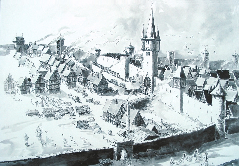
First mentioned in a document of 1237, the town Miltenberg can proudly look back on a turbulent history. Making the best of its conveniently situated position along the busy escort road Nuremberg-Frankfurt next to the Main, Miltenberg grew to be a significant customs point and substantial trading venue. Its most important growth factors were viticulture, wine trade, shipping, timber and stone industry, alongside with trade and craftsmanship.

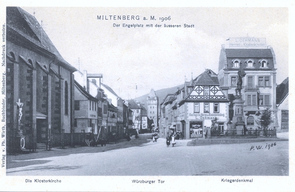
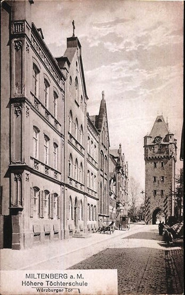
In 1367, Emperor Karl IV granted Miltenberg several privileges, e.g. arranging trade fairs, and implementing the staple right which helped Miltenberg at an early stage to become a thriving medieval trading center. In 1379, the city gates Würzburger and Mainzer Tor were mentioned for the first time and by then the town had already covered an area which was not surpassed before the 1800s.

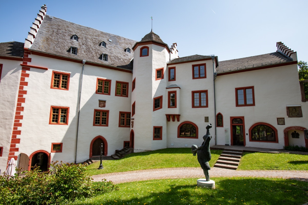
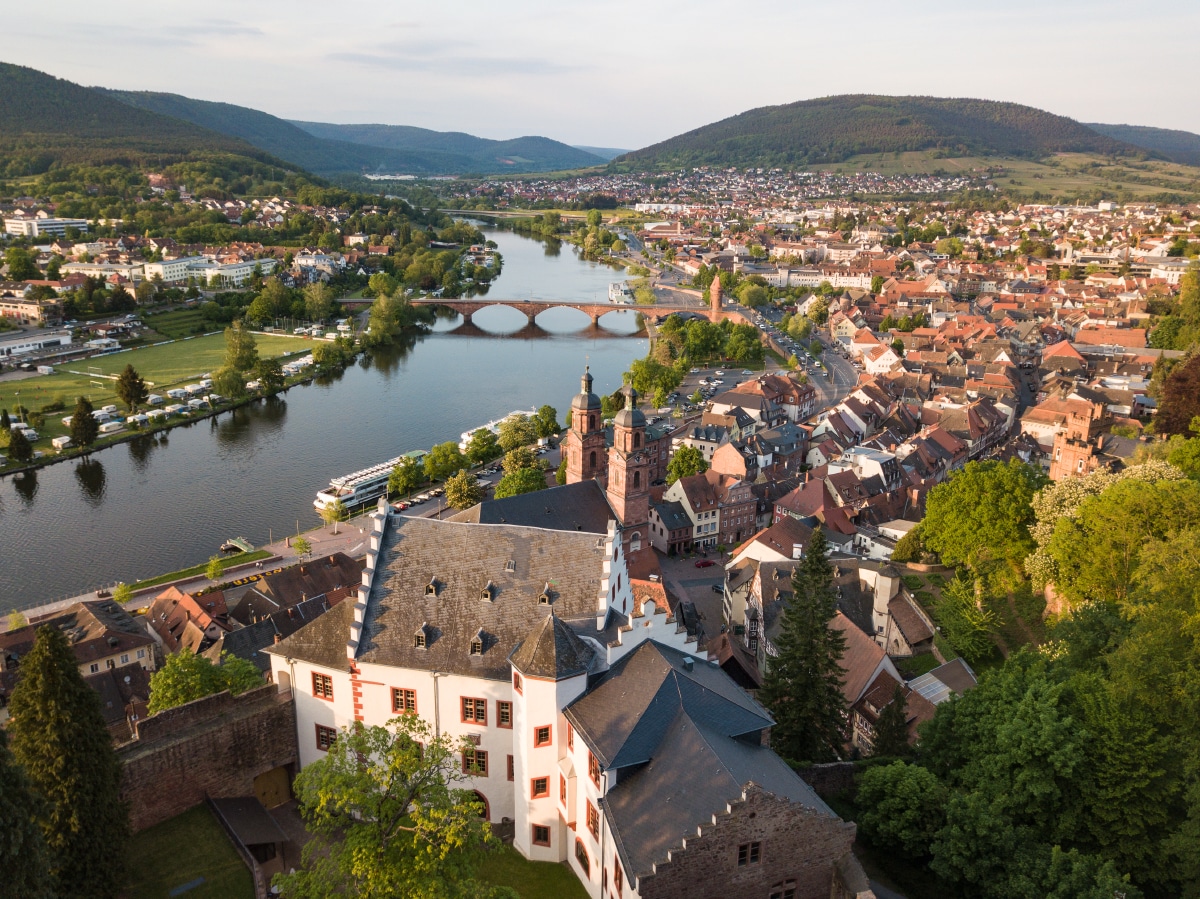
In the Peasant’s War 1525, Miltenberg was not destroyed, but a few years later, in 1552, Miltenberg partly went up in flames during the Margrave War. After that war, Archbishop Daniel Brendel of Homburg initiated the re-erection of the castle.

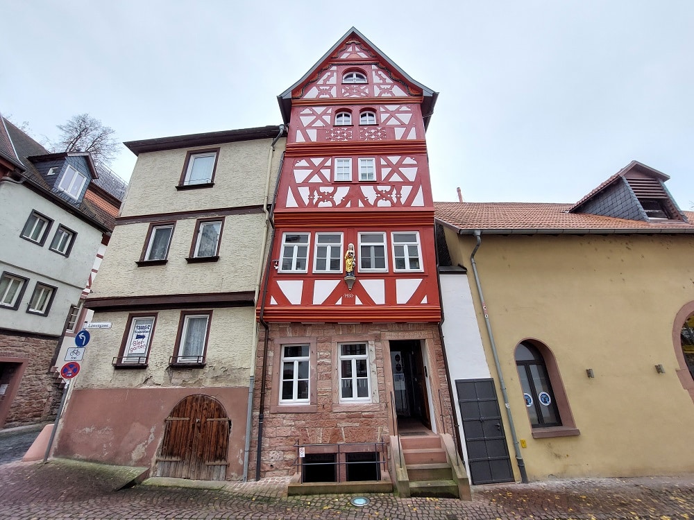
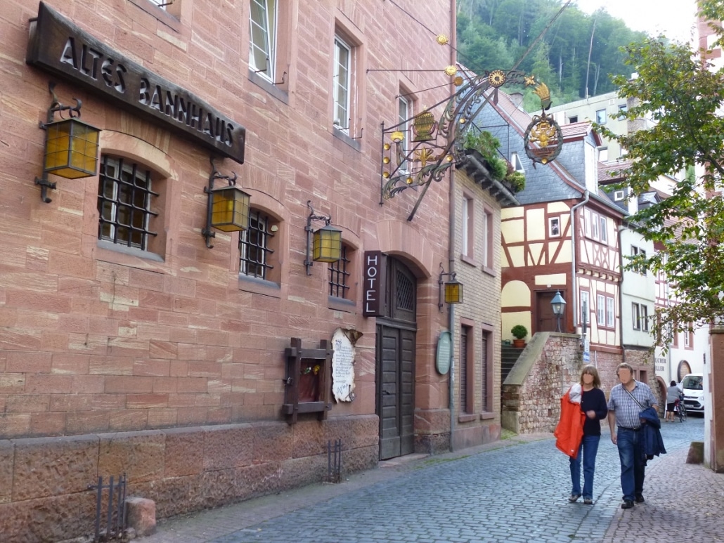
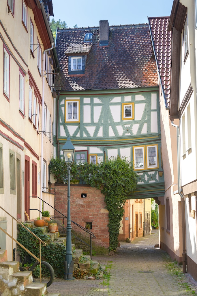
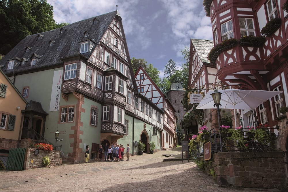
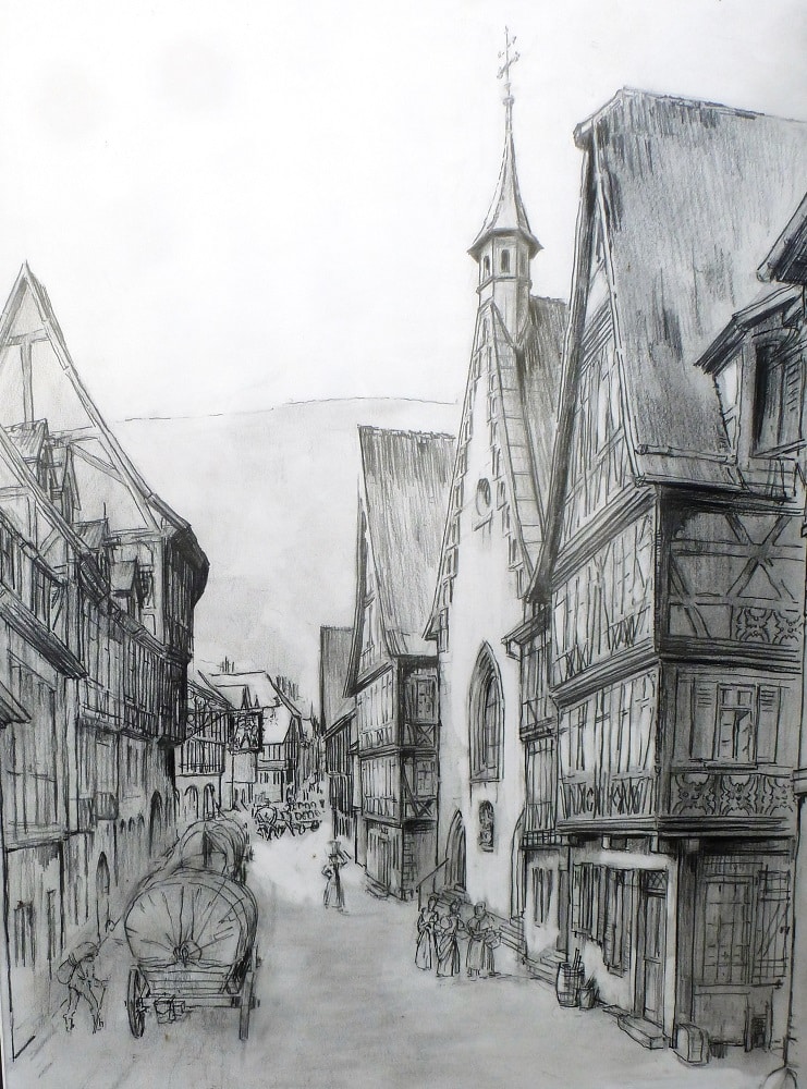
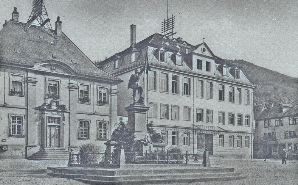
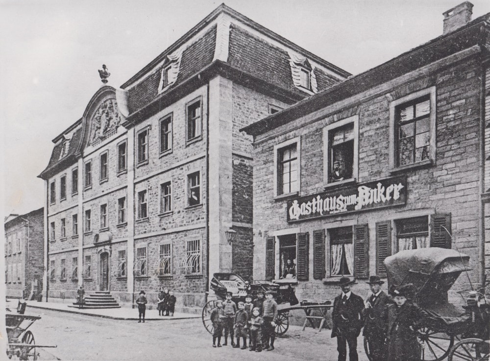
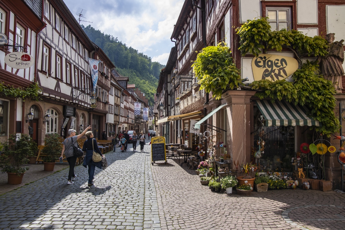
In 1583, the sculptor Michael Juncker created one of the most beautiful renaissance monuments of Miltenberg: The Market Fountain. The Market Square, better known as “Schnatterloch”, is surrounded by magnificent half-timbered houses; e.g. the former Centgrafenhaus, the old Amtskellerei and the Gülden Cron. One of Germany’s oldest taverns, the Gasthaus zum Riesen (The Giant’s Inn), was altered in 1590 to present itself as seen today. Century after century, kings, princes, and other secular and clerical officials would stay in this “princely tavern”.

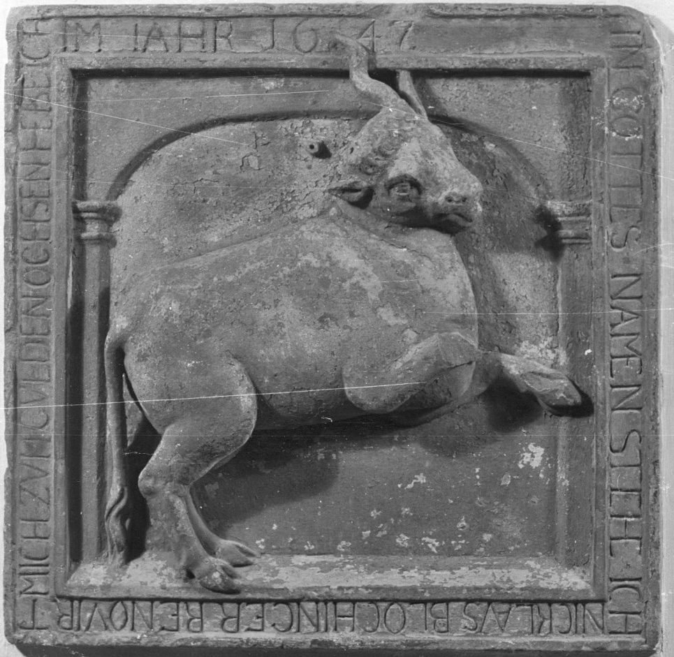
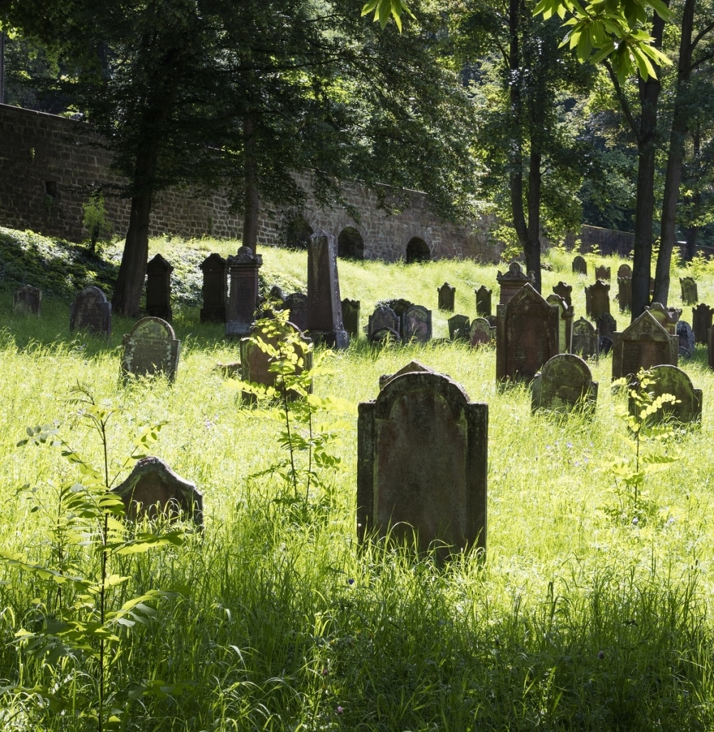
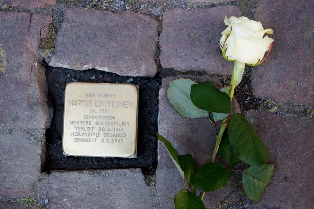
In the 1600s the witch-hunting started. The Mainz territory around Miltenberg was especially affected. Men and women were equally denounced, tortured and executed.

During the Thirty Years War (1618 – 1648), the convenient position along the so-called “Highway of the Middle Ages” which once had helped Miltenberg become a thriving trade center, turned into a disadvantage. The town lost more than half of its population to lootings, pillage, and epidemics, introduced by soldiers because all troops were using that road. The once splendid era was over.

After the electoral state of Mainz had been disestablished in 1803, Prince Leiningen became legal successor of the Archbishop of Mainz. Nevertheless, in 1806, Leiningen already lost its political sovereignty but not its property to the Grand Duchy Baden. In 1810, Miltenberg became Hessian and in 1816 Bavarian.

In 1818, the revocation of previous centuries-old customs and market rights by the Kingdom of Bavaria lead to substantial financial losses. The town lost its former central position and was now located at the outskirts of the Bavarian Kingdom. The main stages of urban development lay in the past but, as hopeless as it seemed then, this situation supported the preservation of the medieval townscape. The award-winning Museum Stadt Miltenberg shows how people used to live here in the course of centuries.

Miltenberg is a member of the “German Half-Timbered House Road”. Under the slogan “half-timbered unites”, the holiday route presents unique landscapes, historic sites, and carefully restored monuments.

Having such an eventful history, Miltenberg can display itself gloriously: A wide main street with marvelous half-timbered houses and medieval alleyways. The oldest, still preserved half-timbered house dates back to 1339.

Miltenberg not only offers a lively present and impressive history, it was also awarded the title Bayerischer Genussort („Bavarian place of culinary delight”). There are only few places in Bavaria (just 100) that can call themselves a “Genussort”.