
New Parish Church

Nr. on the small map: 4 (Bürgstadt) When on March 12th, 1961, the New Parish Church was inaugurated by Bishop Josef Stangl, a long-cherished venture of the locals had finally come true. At the end of the 19th century, additions to the existing Parish Church had already been planned which, more or less, would have […]
Signal Fir Wenschdorf

Signal fires in the Odenwald – The “signal fir” of Wenschdorf-Reichartshausen The highest mountains in the Odenwald used to be connected by a network of signal stations, which made it possible to transmit important messages from one end of the mountain range to the other in a short time and to warn the population of […]
Ancient Roman Watch Tower
The UNESCO listed the Upper Germanic-Rhaetian Limes as World Heritage in 2005. The Romans were in our area from about 160 to 250 AD and left astonishing marks of their presence. The Imperial Limes Commission excavated the sites of the watch towers around 1890. In the years 2010 and 2011 the foundations of three watch […]
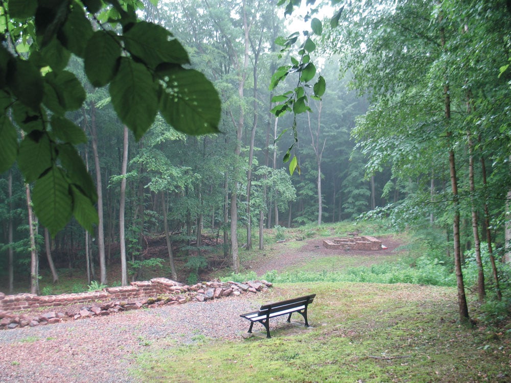
Haagsaussicht (“View Point by the Wood”)
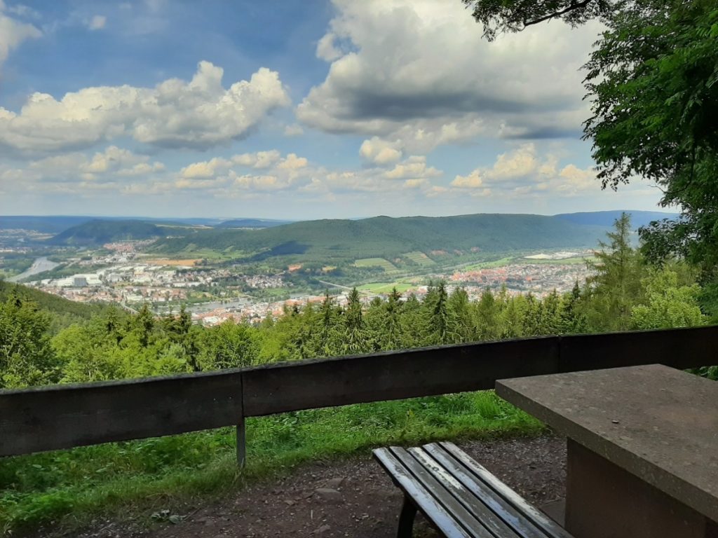
Haag = small wood This enchanting view point was established on a heap of rubble left from the nearby quarries. The bunter sandstone mined here is fine-grained, of a deep red colour, strong enough for buildings and soft enough for carving sculptures. In 1890 the first sandstone was quarried in this place, which was extended […]
Soil Profile Stele
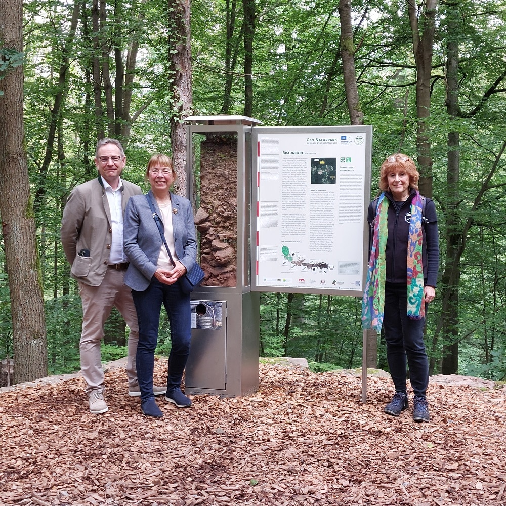
This stele gives you intriguing information about the soil, its origin, composition and what it means for the forest, nature and climate. All this has been laid out clearly on two presentation boards (front and back). The soil profile stele itself presents the individual layers and their characteristics.
Blockfield (“Felsenmeer”) and Circular Hiking Trail “3 im Wald” (“3 in the Forest”)
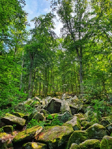
Nr. on the small map: 17 (Miltenberg)“Felsenmeer”The spectacular natural monument “Felsenmeer” is situated above the Schnatterloch and is a product of geological processes which started approximately 245 m years ago. At that time, the Odenwald was part of a semi-desert-like landscape. River sediments fossilizing over millions of years formed the red bunter sandstone. During the […]
Ringfort on Top of the Mountain „Greinberg“
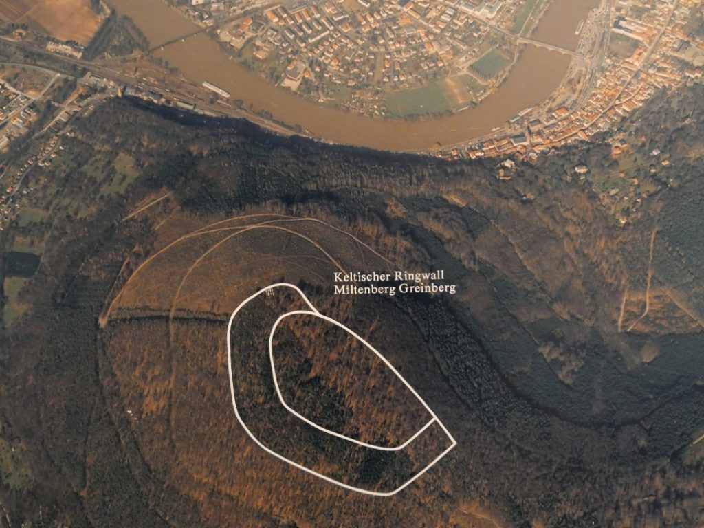
Nr. on the small map: 3 (Miltenberg) The Greinberg dominates the Main Valley at Miltenberg. Findings from the Bronze Age confirm that the area was inhabited between 1700 -1200 BC. The ringfort has two ramparts around the mountain’s brow (highest elevation 452 m / 494 yd above sea level). The outer rampart covers an area […]
Roman Fort „Cohort“ Miltenberg / “Old Town”
Nr. on the small map: 2 (Miltenberg)Around 159/169 AD, the Romans extended their borderline, the so-called Limes, all the way to the “Miltenberg Mainknie” (Main River Knee) and here they secured the passage from a river to a land boundary with two forts. Almost 500 soldiers, infantry as well as cavalry, protected the fort Cohort, […]
Heunesäulen (“Giants’ Pillars”)
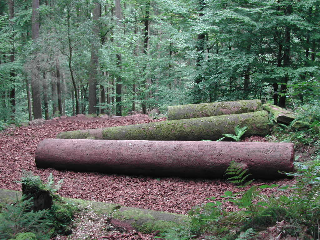
Nr. on the small map: 1 (Miltenberg)The Romans already exploited red bunter sandstone needed for their forts around Miltenberg. The so-called “Heunesäulen” bear witness of the “Red-Sandstone-processing” during the (later) Middle Ages. They were carved from a block field at the Bullauer Berg, located between Miltenberg and Mainbullau. The five stately bunter-sandstone-pillars are 7 m […]
Malakoff Tower
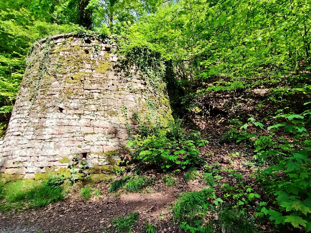
This structure was built to support the walls around the property of the mansion “White Palace” in 1870. It was nicknamed “Malakoff Tower” for the fort Malakoff near Sevastopol. This fort withstood a long siege during the Crimean War, before it finally fell. The name Malakoff then became a synonym for strength, resilience and toughness.