

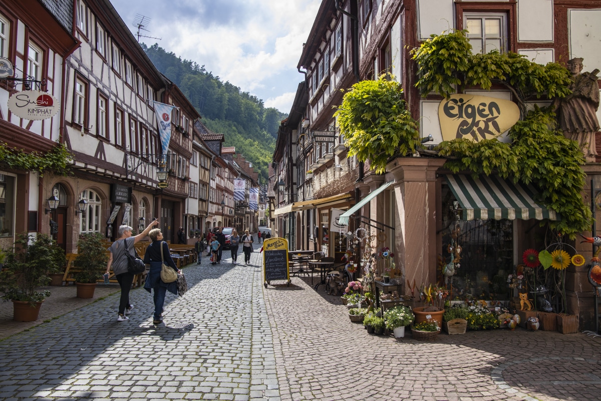
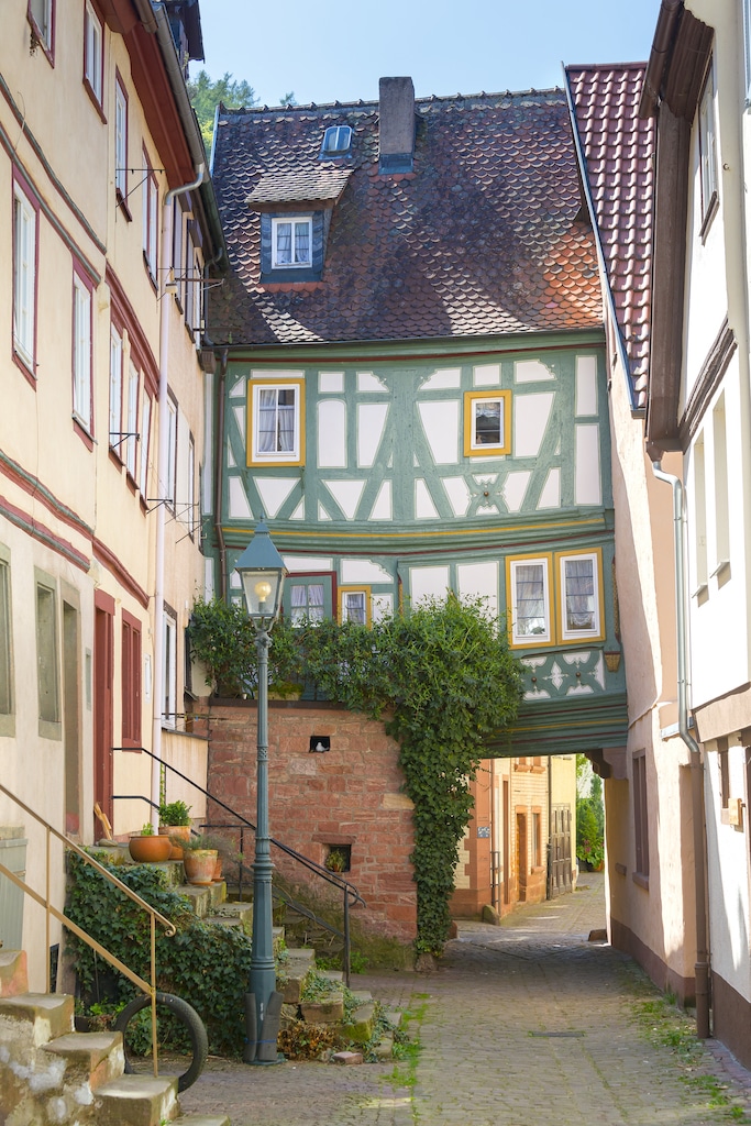
“Schwarzviertel” (“Black Quarter”)
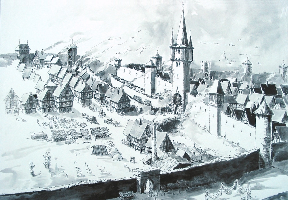
Nr. on the small map: 8 (Miltenberg)The Schwarzviertel (black quarter) is the oldest part of Miltenberg with a lot of beautiful half-timbered houses, located between the Schwertfeger Gate and the

House of the Bischoff Family
The tanning family Bischoff moved from Amorbach to Miltenberg in 1669. Here, in the Schwarzviertel, they successfully ran their business. The tanning pits were outside the city walls, near the

Mikvah
Nr. on the small map: 9 (Miltenberg) This narrow, four-storey building with decorative framework was built in the late 16th century.In the cellar there is a former mikvah. Mikvah is

Bann Haus
Nr. on the small map: 10 (Miltenberg) From the 13th century until 1780, the old Bann House used to be a customs office for Mainz. In its courtyard there are

Former Superior Bailiwick (Oberamt „Adelshof“)
Nr. on the small map: 11 (Miltenberg) The former Oberamt (Superior Bailiwick) was originally an aristocratic court. In its present appearance it dates back to the family
First Synagogue
Nr. on the small map: 12 (Miltenberg) Around 1290, the first synagogue was built. It is one of the oldest sacred Jewish buildings of Europe that has retained its original
Pfarrgasse 6
The oldest document mentioning this building dates from 1646. At that time, it was a swineherd’s home. The house may very well be even older. The supporting buildings date from

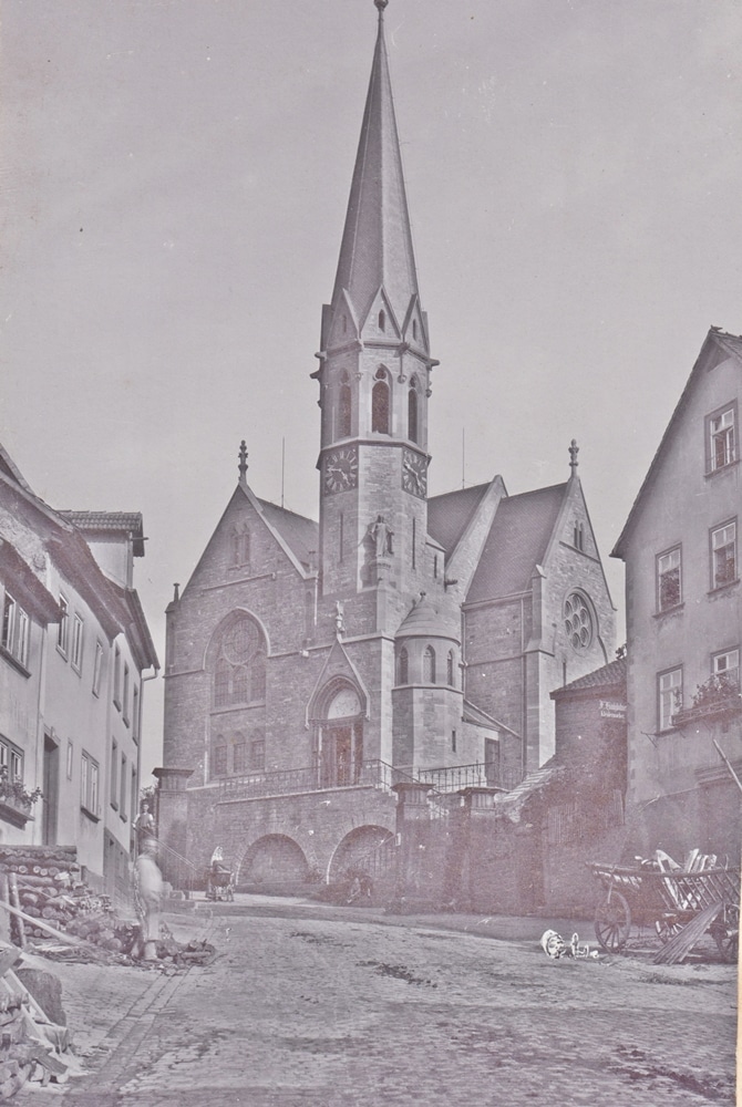
Parish Church „St. James the Great“
Nr. on the small map: 13 (Miltenberg) The Church “St. James the Great” had already existed since the early days of Miltenberg in the 13th century but has frequently been
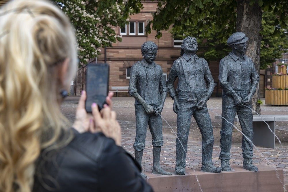
Staffelbrunserbrunnen (“Stair-Pee-ers’ Well”)
Nr. on the small map: 14 (Miltenberg) A lot of towns have mocking names which nowadays are mainly used during Carnival season. Citizens of Miltenberg are the “Staffelbrunser” (“Stair Pee-ers”:
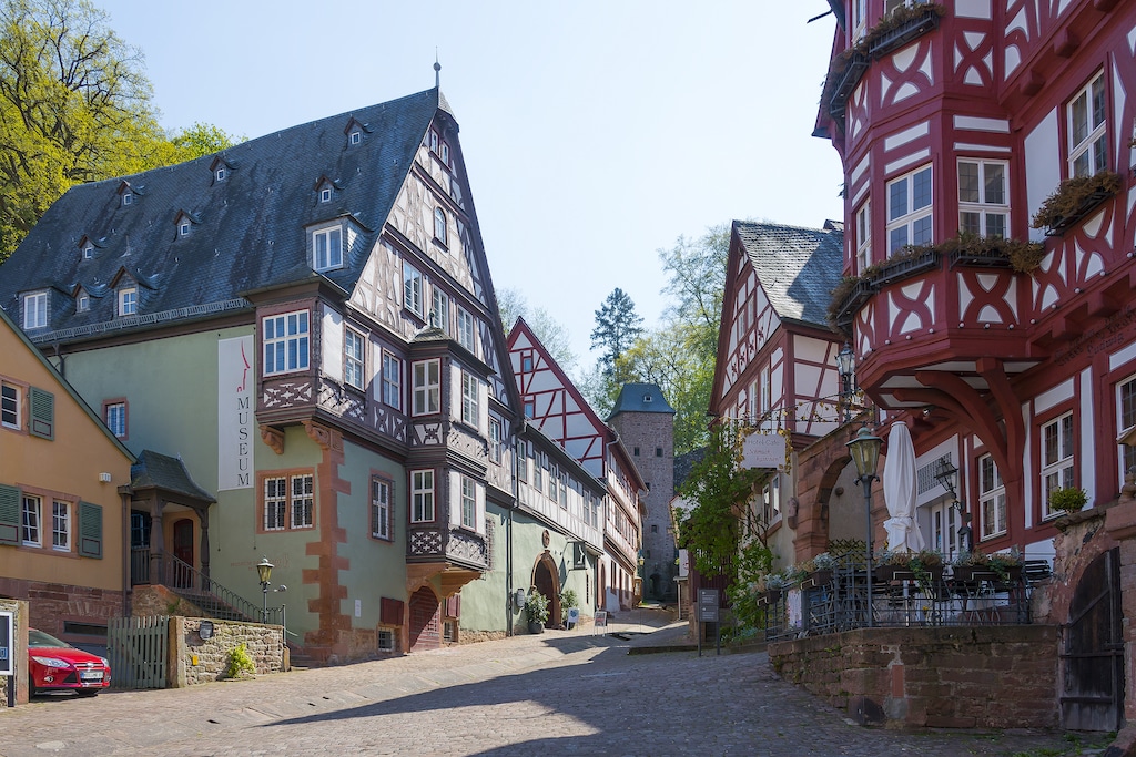
Museum Stadt Miltenberg
Nr. on the small map: 18 (Miltenberg) In 1541, the main building was constructed by Bernhard von Hardheim, an amtmann (kind of “bailiff”) of Mainz. It was used as an

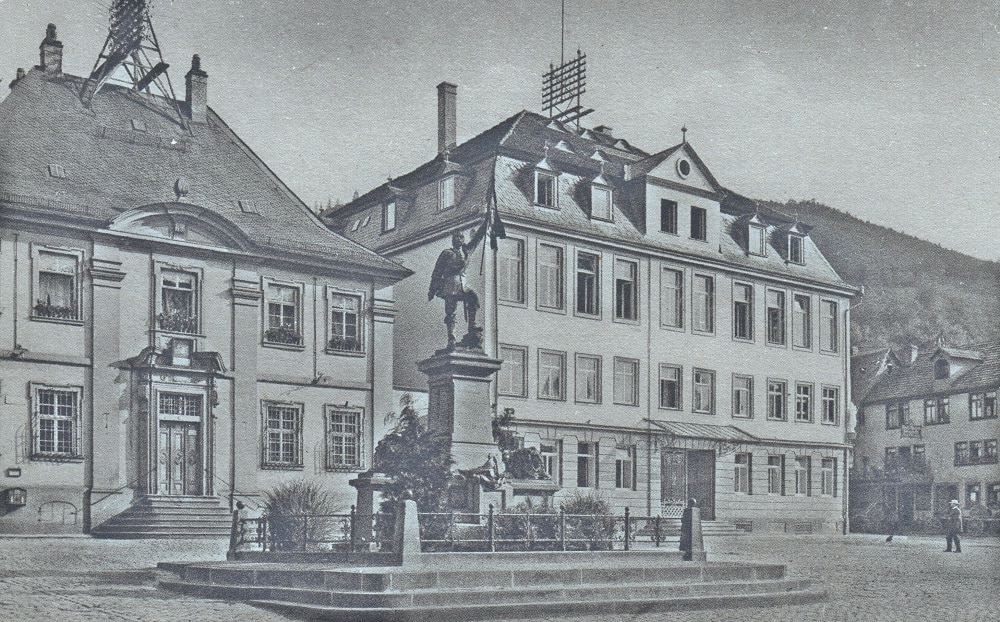
Market Square with Market Fountain
Nr. on the small map: 15 (Miltenberg) Without a doubt, the market square with its market fountain is the center of town. The ensemble, which strikes a balance, honors the

Schnatterlochturm
The designation „Schnatterloch“ comes from the medieval German word „snade“, which means “gash” or “swath”. Originally it was a drain resembling a gully and lead down to the Main river.
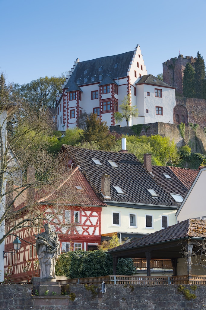
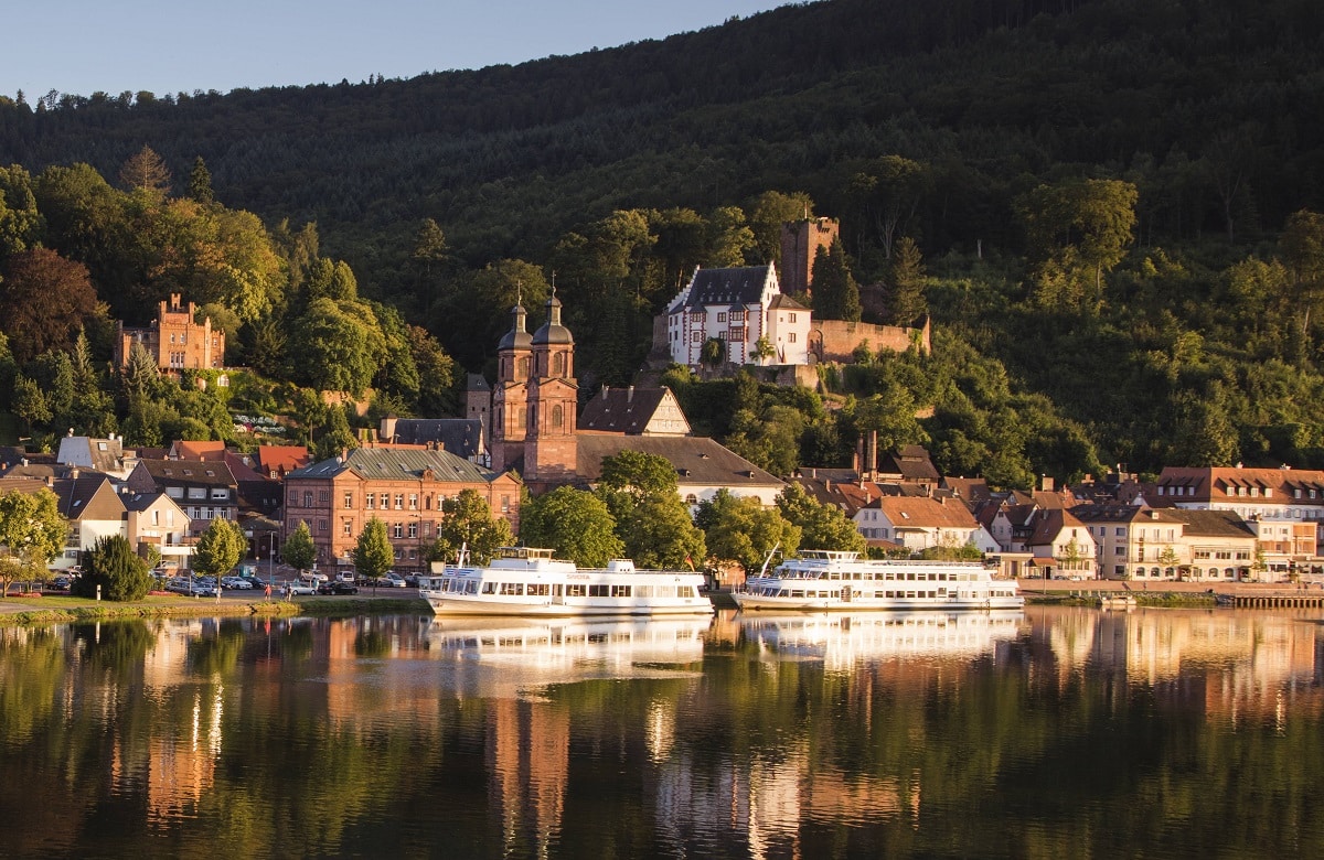
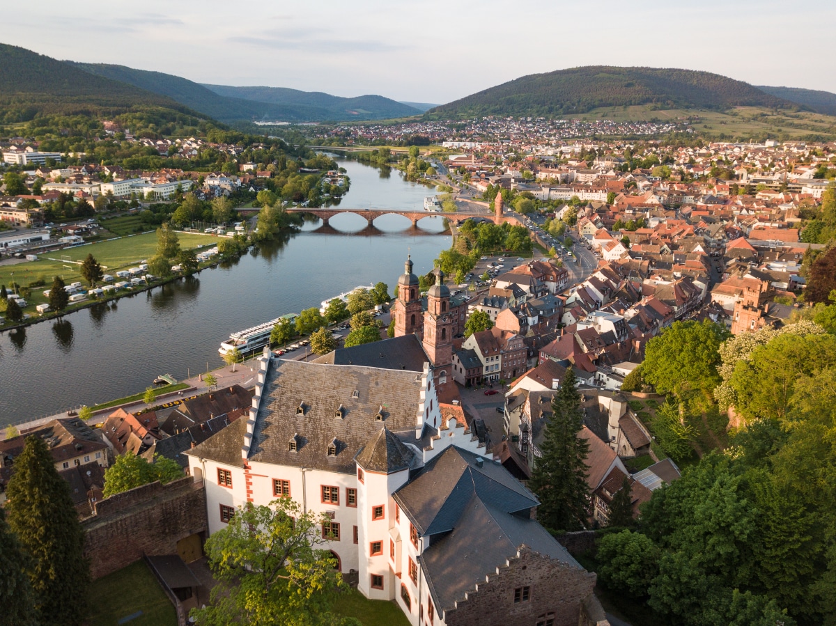
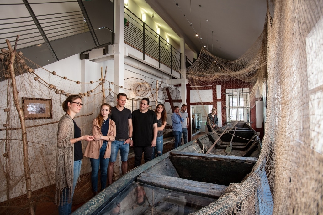
Museum Burg Miltenberg and Mildenburg Castle
Nr. on the small map: 16 (Miltenberg) King Conrad III most likely gave Burkard, a member of the edelfreien (“free knights”) Lords of Weinsberg, the order to build the Mildenburg

Composer Joseph Martin Kraus and the Baroque House at the Market Square
Nr. on the small map: 19 (Miltenberg) This house was built in 1750/51 by architect, builder and contractor Johann Martin Schmidt (1700 – 1763) as his own prestigious private residence.
Hümplerhof
In spite of looking rather inconspicuous today, this was the “Hümplerhof”, the guild house of the bargees and fishermen from the 14th century until 1671. “Hümpler” were owners of small

New Synagogue
Miltenberg probably had a Jewish community from the very beginning. The first synagogue of Miltenberg was built in the late 13th century. After a long history of many ups and

Historic Town Hall
Nr. on the small map: 20 (Miltenberg)The historic town hall was first mentioned in 1379 as the weigh house. Its upper floor was additionally used as dance and council hall,
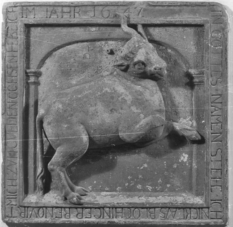
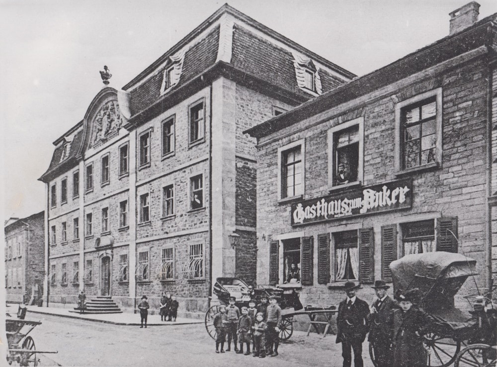
Zum Goldenen Ochsen
Constructed in 1387, number 108 is the corner house. The name of the restaurant Zum Goldenen Ochsen (the Golden Ox), which was later built here, is derived from a family
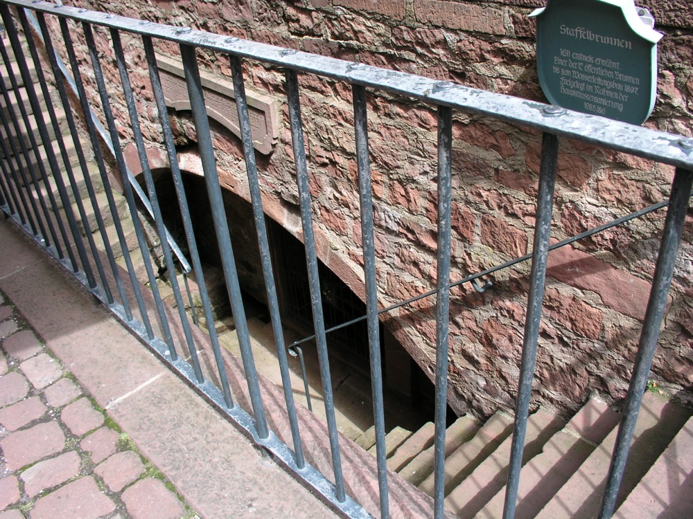
Staffelbrunnen (Stair Well)
Nr. on the small map: 21 (Miltenberg)Up to 1897, 10 to 12 wells were the only water supply for the town. The Stair Well, which had been built around 1600

Apothecary Museum
Nr. on the small map: 22 (Miltenberg) In 1514, the first pharmacy in this area – which was under the Mainz electorate – was established in Miltenberg. The fact that

Inn Zum Riesen (The Giant)
Nr. on the small map: 23 (Miltenberg) In 1411, the tavern Zum Riesen was first officially mentioned. However, it is most likely considerably older. In 1504 it is named a
Hospital
The hospital was founded by Archbishop Peter von Aspelt before 1319. It also offered medical treatment for ill wagoners and traders. The half-timbered house was built in 1543/44. It served
Wammesser Gate and Town Walls
Miltenberg grew quickly in its early years and saw its first expansion around 1300. The eastern border was marked by the Wammesser gate. The gate, which was removed in 1784,

Town Wall and “Witch Huts”
Nr. on the small map: 24 (Miltenberg)Having had at least 200 victims in total, evenly divided between the male and female sex, the district of Miltenberg (about 6500 residents) was

Older Jewish Cemetery
Nr. on the small map: 25 (Miltenberg) The Older Jewish Cemetery of Miltenberg was already established in the 15th century. It was in use until 1900. From 1901 on the
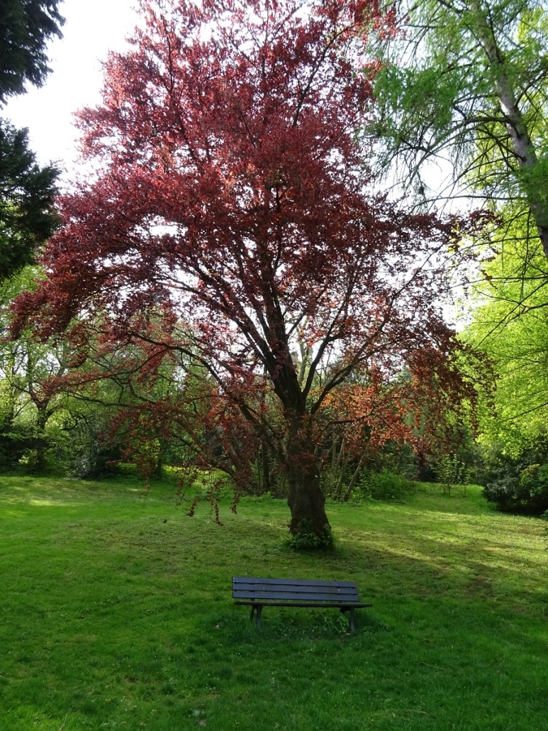
Town Park (Arboretum)
Nr. on the small map: 26 (Miltenberg)At the end of the 19th century, the town park of Miltenberg was laid out by Gustav Jakob, a wealthy citizen of Miltenberg, in

Lutheran Church John the Apostle
Nr. on the small map: 27 (Miltenberg)The Lutheran Church was built in 1897 and, because of its architecture and choice of material, well worth a visit. The Statue of Christ
Vögelein’s Gate
In this place the so called “Upper Gate” was taken down in 1827/28. Eight cartloads of building stones were delivered for the “4 columns at the New Gate”. The statue

Main River Bridge
Nr. on the small map: 28 (Miltenberg) The passage across the Main River near Miltenberg had already been very important in the Middle Ages.Initially, ferries crossed the river near the
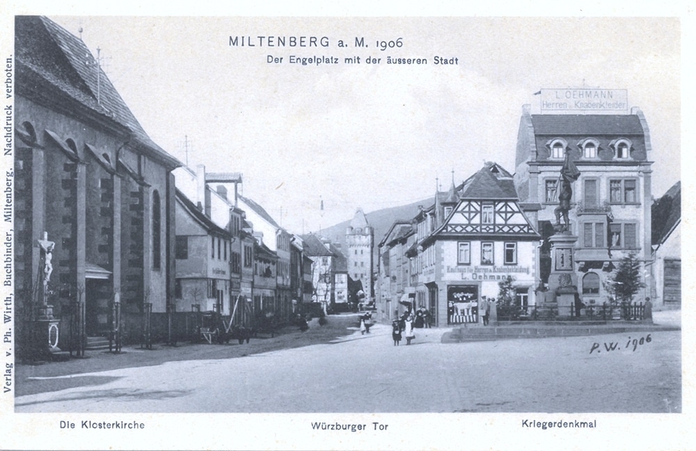
Square Engelplatz
Today’s Engelplatz („Angel’s Square“) was used for various purposes throughout the centuries:Before Miltenberg was extended for the second time in the late 14th century, today’s Engelplatz belonged to Bürgstadt. After
Former Post Office
Built in 1712 in the Baroque style, this building was the town house of Bernhard Rödinger, who was the archiepiscopal bailiff. It was used as a post-office from 1824 to

Tourist Information and Town Hall
The carpenter, architect and builder Jakob Stoer built today’s town hall in the early 17th century. For a while it was also used as the bailiff’s administrative building. In the
Monument “DenkOrt Deportationen 1941 – 1944”
In memory of the Jewish citizens of Miltenberg 1933 – 1945 They were humiliated, robbed, driven away and deported. 30 people who had lived in Miltenberg in 1939 were murdered

Franciscan Monastery
Nr. on the small map: 30 (Miltenberg)The Franciscans, already established in town since 1630, lived in the hospital. Due to the Thirty Years War, the construction of their new home
Former Archiepiscopal Tithe House (Hartigsbau)
Nr. on the small map: 31 (Miltenberg) The archiepiscopal bailiff’s seat received its name Hartigsbau honoring its owner in the 19th century. Beforehand, it had been the administrative center of
Former Court House
Built in 1779 as the customs office of the archbishop of Mainz it became the temporary residence of the Prince of Leiningen in 1802. After a short use as an
Institut der Armen Schulschwestern (School Sisters)
In 1851 the priest Dr. Franz Ludwig Bardum invited the School Sisters of Notre Dame to teach at the girls’ school and to manage the orphanage and the primary school

Civil Settlement (Vicus) of the Roman Fort Numerus
Nr. auf dem Plänchen: 32 (Miltenberg) In 1998, during construction works at house Maria Regina, a craftsmen’s site of a civil settlement was excavated. It had been part of the

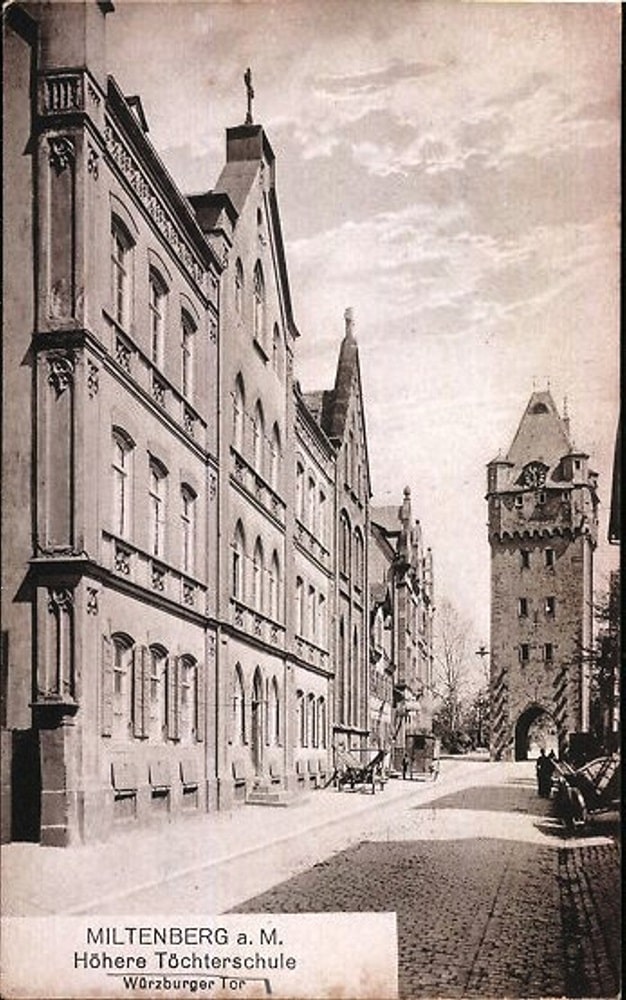
Würzburg Gate
Nr. on the small map: 33 (Miltenberg)The Würzburg Gate was built before 1379 with a platform and battlement on top. The roof was only added in the early 15th century.
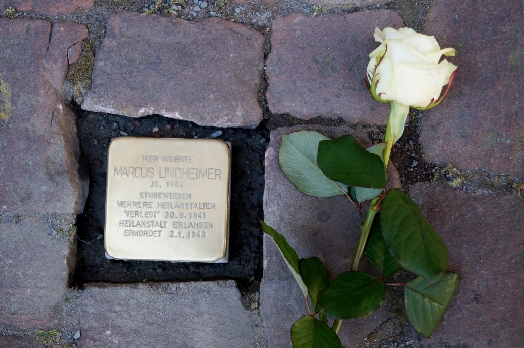
Stolpersteine (Stumbling Stones)
Gunter Demnig laid the first nine “Stolpersteine” (“stumbling stones”) in Miltenberg in May 2016, by the instigation of the Initiative “Miltenberger Stolpersteine – GEGEN DAS VERGESSEN” (“Miltenberger Stolpersteine – FIGHT
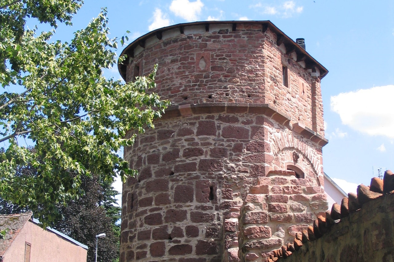
Tower “Zuckmantelturm”
Nr. on the small map: 34 (Miltenberg)The “Zuckmantelturm” was erected in 1451 and rebuilt several times. Its location and architectural design suggest it was a cornerstone guarding the south eastern

Museum Burg Miltenberg and Mildenburg Castle
Nr. on the small map: 16 (Miltenberg) King Conrad III most likely gave Burkard, a member of the edelfreien (“free knights”) Lords of Weinsberg, the order to build the Mildenburg

Town Park (Arboretum)
Nr. on the small map: 26 (Miltenberg)At the end of the 19th century, the town park of Miltenberg was laid out by Gustav Jakob, a wealthy citizen of Miltenberg, in

St. Lawrence’s Bridge and Statue St. John of Nepomuk
The medieval bridge was partly destroyed during the disastrous “St. Michael’s Flood” on 29th September 1732. The builder Johann Martin Schmidt from Miltenberg was commissioned with the reconstruction.The statue of

Chapel St. Lawrence
The Chapel St. Lawrence was first mentioned in 1380. The choir dates back to 1456, the nave was extended in 1594. The late Gothic winged altarpiece from 1509, the frescos

Mainz Gate
Nr. on the small map: 5 (Miltenberg)The Mainz Gate, sometimes called Mainz Tower, was first mentioned in 1379, as the utmost western borderline of the town. The Mainz Gate to

Sachsengrab (Saxons’ Grave)
Nr. on the small map: 6 (Miltenberg)On April 12th, 1814, 62 soldiers of the light infantry „Banner der freiwilligen Sachsen” (Banner of Voluntary Saxons) and three local ferrymen died when

Schwertfegertor (Sword Cutler’s Gate)
Nr. on the small map: 7 (Miltenberg)The Schwertfeger Gate was the westernmost boundary of the town after the first extension around the year 1300. It was probably named for a

Bismarcksruhe (Bismarck’s Rest)
The wealthy globetrotter and citizen of Miltenberg, Johann Robert von Capitain, gave the „Association for the beautification of Miltenberg“ a small piece of the grounds above today’s Conradyweg in about

Malakoff Tower
This structure was built to support the walls around the property of the mansion “White Palace” in 1870. It was nicknamed “Malakoff Tower” for the fort Malakoff near Sevastopol. This
Town Park (Arboretum)
Nr. on the small map: 26 (Miltenberg)At the end of the 19th century, the town park of Miltenberg was laid out by Gustav Jakob, a wealthy citizen of Miltenberg, in

Heunesäulen (“Giants’ Pillars”)
Nr. on the small map: 1 (Miltenberg)The Romans already exploited red bunter sandstone needed for their forts around Miltenberg. The so-called “Heunesäulen” bear witness of the “Red-Sandstone-processing” during the (later)

Roman Fort „Cohort“ Miltenberg / “Old Town”
Nr. on the small map: 2 (Miltenberg)Around 159/169 AD, the Romans extended their borderline, the so-called Limes, all the way to the “Miltenberg Mainknie” (Main River Knee) and here they

Ringfort on Top of the Mountain „Greinberg“
Nr. on the small map: 3 (Miltenberg) The Greinberg dominates the Main Valley at Miltenberg. Findings from the Bronze Age confirm that the area was inhabited between 1700 -1200 BC.

Blockfield (“Felsenmeer”) and Circular Hiking Trail “3 im Wald” (“3 in the Forest”)
Nr. on the small map: 17 (Miltenberg)“Felsenmeer”The spectacular natural monument “Felsenmeer” is situated above the Schnatterloch and is a product of geological processes which started approximately 245 m years ago.

Soil Profile Stele
This stele gives you intriguing information about the soil, its origin, composition and what it means for the forest, nature and climate. All this has been laid out clearly on

Haagsaussicht (“View Point by the Wood”)
Haag = small wood This enchanting view point was established on a heap of rubble left from the nearby quarries. The bunter sandstone mined here is fine-grained, of a deep

Ancient Roman Watch Tower
The UNESCO listed the Upper Germanic-Rhaetian Limes as World Heritage in 2005. The Romans were in our area from about 160 to 250 AD and left astonishing marks of their

Signal Fir Wenschdorf
Signal fires in the Odenwald – The “signal fir” of Wenschdorf-Reichartshausen The highest mountains in the Odenwald used to be connected by a network of signal stations, which made it