
Bismarcksruhe (Bismarck’s Rest)
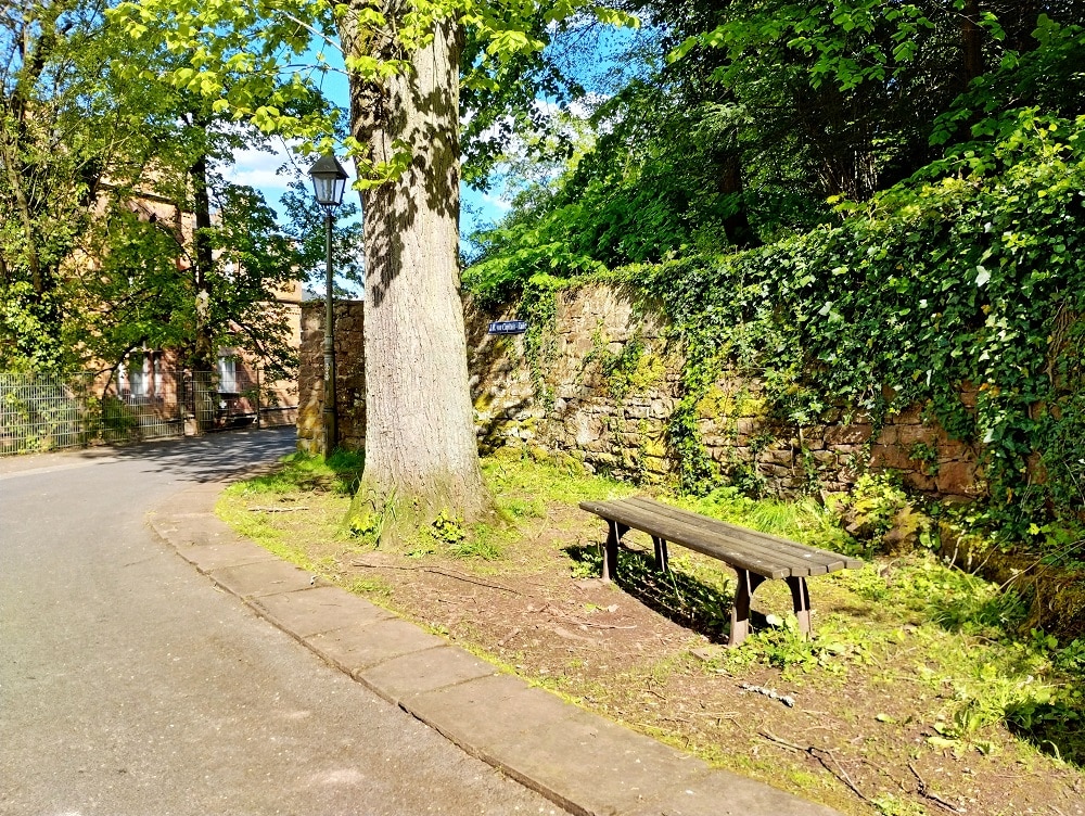
The wealthy globetrotter and citizen of Miltenberg, Johann Robert von Capitain, gave the „Association for the beautification of Miltenberg“ a small piece of the grounds above today’s Conradyweg in about 1875 to put up a resting bench in this place. The association called the location of the bench “Bismarck’s Rest” in honor of Chancellor Otto […]
Schwertfegertor (Sword Cutler’s Gate)
Nr. on the small map: 7 (Miltenberg)The Schwertfeger Gate was the westernmost boundary of the town after the first extension around the year 1300. It was probably named for a sword cutler who worked there. After 1650 the guards were moved from the Mainz Gate back to the Schwertfeger Gate. When the street was extended […]
Sachsengrab (Saxons’ Grave)
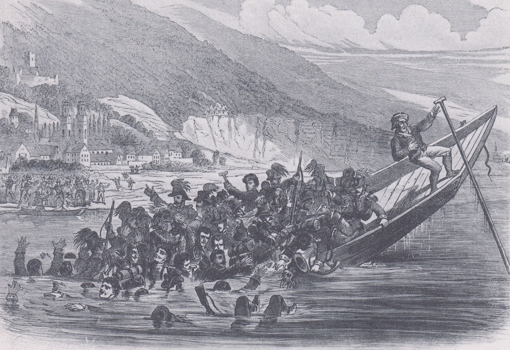
Nr. on the small map: 6 (Miltenberg)On April 12th, 1814, 62 soldiers of the light infantry „Banner der freiwilligen Sachsen” (Banner of Voluntary Saxons) and three local ferrymen died when the overloaded ferry capsized. The soldiers were on their way to France to fight Napoleon, but were delayed – not only due to the accident. […]
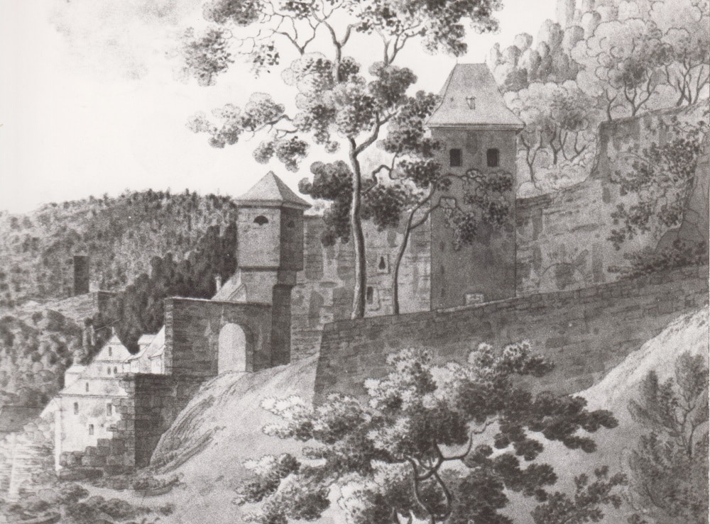
Mainz Gate
Nr. on the small map: 5 (Miltenberg)The Mainz Gate, sometimes called Mainz Tower, was first mentioned in 1379, as the utmost western borderline of the town. The Mainz Gate to the west and the Würzburg Gate to the east are about 2 km apart from each other. They originally formed the town’s boundaries. The crest […]
Chapel St. Lawrence
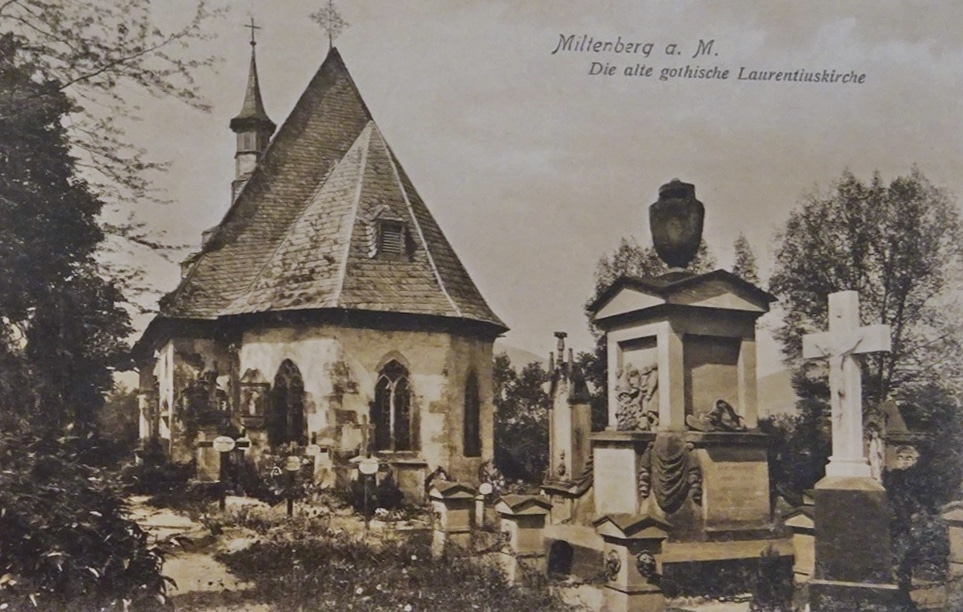
The Chapel St. Lawrence was first mentioned in 1380. The choir dates back to 1456, the nave was extended in 1594. The late Gothic winged altarpiece from 1509, the frescos in the choir, the stone statue of St. Lawrence right from 1456, the statue “Mary and the Child” from around 1470, and the carved epitaph […]
St. Lawrence’s Bridge and Statue St. John of Nepomuk
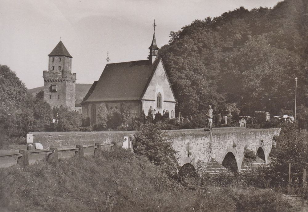
The medieval bridge was partly destroyed during the disastrous “St. Michael’s Flood” on 29th September 1732. The builder Johann Martin Schmidt from Miltenberg was commissioned with the reconstruction.The statue of Saint John of Nepomuk was donated by the pharmacist Gregor Jost Gischeit (1688 – 1730) from Miltenberg. The donation can be dated by reading the […]
Tower “Zuckmantelturm”
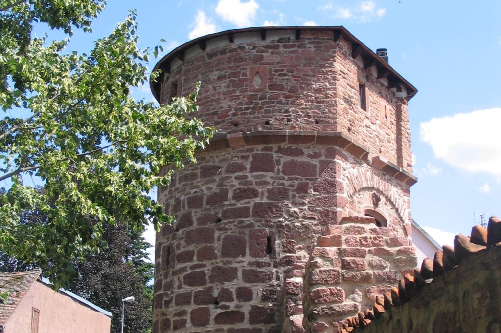
Nr. on the small map: 34 (Miltenberg)The “Zuckmantelturm” was erected in 1451 and rebuilt several times. Its location and architectural design suggest it was a cornerstone guarding the south eastern town boundary. Here the town was extremely vulnerable.
Stolpersteine (Stumbling Stones)
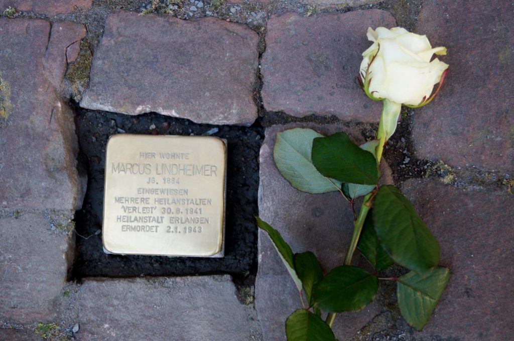
Gunter Demnig laid the first nine “Stolpersteine” (“stumbling stones”) in Miltenberg in May 2016, by the instigation of the Initiative “Miltenberger Stolpersteine – GEGEN DAS VERGESSEN” (“Miltenberger Stolpersteine – FIGHT OBLIVION”). Meanwhile 44 “Stolpersteine” have been laid, commemorating 44 people who were either murdered by Nazis or driven to their deaths. Detailed information on “Stolpersteine” […]
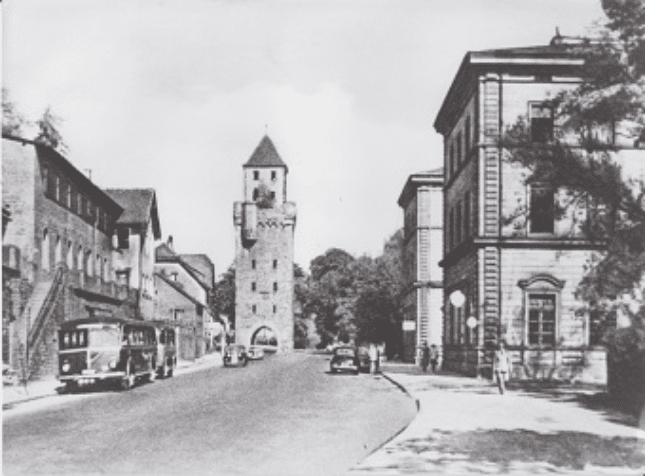
Würzburg Gate

Nr. on the small map: 33 (Miltenberg)The Würzburg Gate was built before 1379 with a platform and battlement on top. The roof was only added in the early 15th century. It has five levels plus a warder’s apartment. In the 18th century it was used as a prison. Two warders granted entry, collected tolls and […]
Civil Settlement (Vicus) of the Roman Fort Numerus

Nr. auf dem Plänchen: 32 (Miltenberg) In 1998, during construction works at house Maria Regina, a craftsmen’s site of a civil settlement was excavated. It had been part of the Roman Fort Numerus, situated about 300 m east (linear) between the Mittel- and Berufsschule. A melting pit, two pottery kilns, and remains of three wooden […]