
Waldlehr- und Erlebnispfad (“Forest Nature and Adventure Trail”)

Nr. on the small map: 11 (Bürgstadt) Cultural and Youth Trail on the Nibelungensteig Along the approximately 2 km of the forest nature and adventure trail, 11 stages not only offer edutainment but also breathtaking scenic views. There are plenty of interesting activities and adventures for all ages alike; even suitable for families with strollers or […]
European Culture Trail “Mainhölle” and “Abundance of Images”
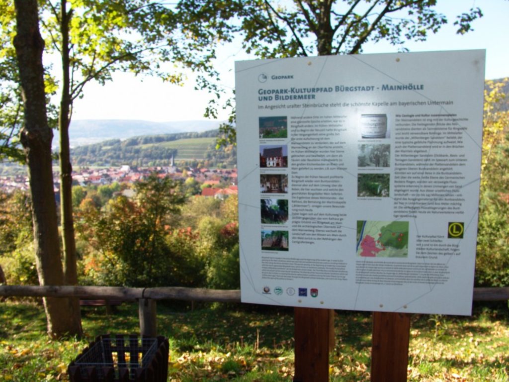
Nr. on the small map: 10 (Bürgstadt) Mainhölle (Main-hell) is the name of the quarries opposite Bürgstadt which can be seen from the European Culture Trail. The Red Sandstone is bedrock for the flourishing of Bürgstadt’s wines and the resulting fortune. It facilitated the realization of the “Abundance of Images” inside the Martinskapelle. Starting point is […]
Stutzkapelle (Chapel)

Nr. on the small map: 13 (Bürgstadt) The Stutzkapelle was built during the Marian year 1954 with own efforts and donations by the Kolping-family of Bürgstadt. The municipality provided the premises complimentary. Every first Sunday of the month, the Rosary is prayed here. Links to our partners:Gäste-Info Bürgstadt e.V.Heimat- und Geschichtsverein Bürgstadt e.V.
Historic Bridge on the River Erf
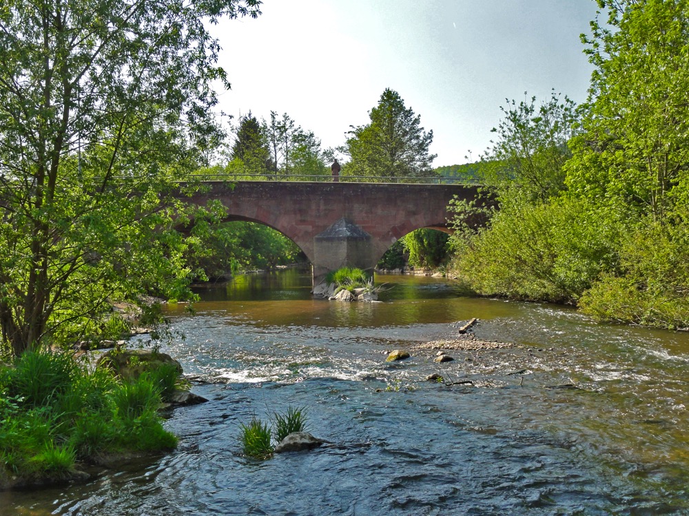
Nr. on the small map: 3 (Bürgstadt) The year 1538 is the first time a bridge across the River Erf was mentioned. On St. Michael’s Day in 1732 (Sep 29th), it was damaged by a devastating flood. In the same year, a boardwalk was timbered and later a massive wooden bridge, which was stone-flagged in […]
Lower Mill
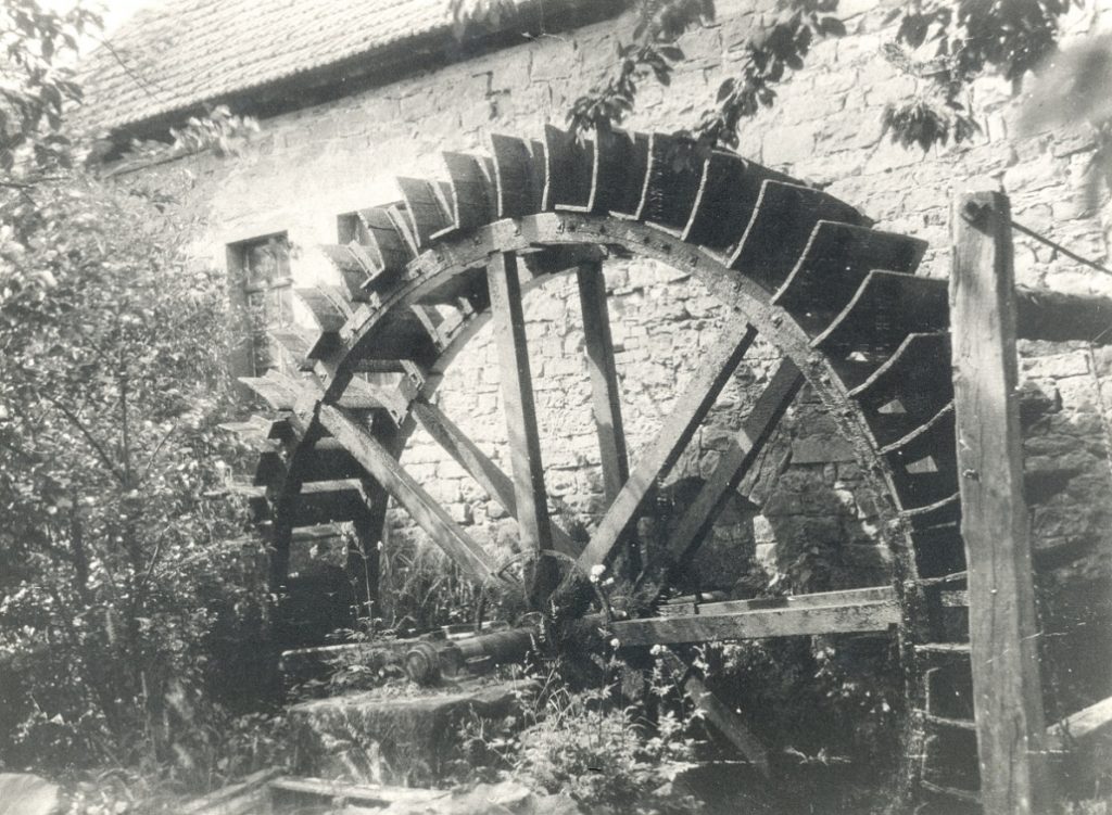
Nr. on the small map: 2 (Bürgstadt)The Lower Mill most likely dates back to the 13th century. During its use, it served as a grain, oil and fulling mill. Floods and fires have always been risks for mills. A report about the Michelswasser in 1732 was handed down describing the hazards for a running mill. […]
Museum Bürgstadt
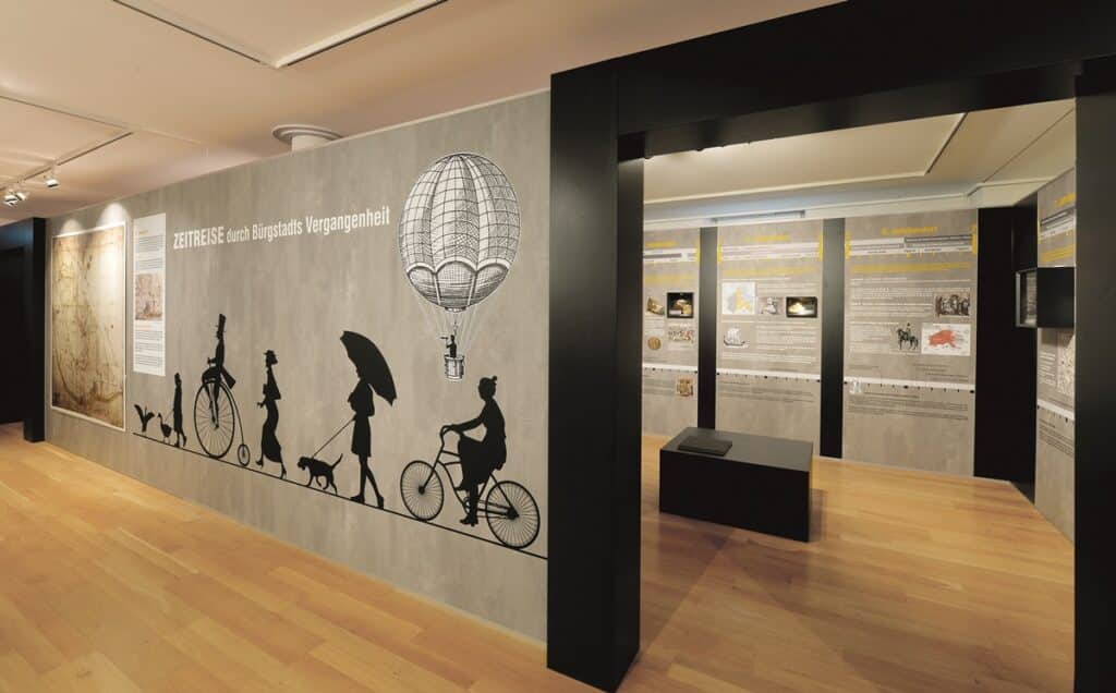
Nr. on the small map: 1 (Bürgstadt) In the Museum Bürgstadt timelines show the local historical events in relation to church history and trans-regional history. This way the museum presents the history of the region in a seamless graphic way, beginning in prehistoric times and going century by century to our time. The location – the old […]
Martinskapelle (St. Martin’s Chapel)
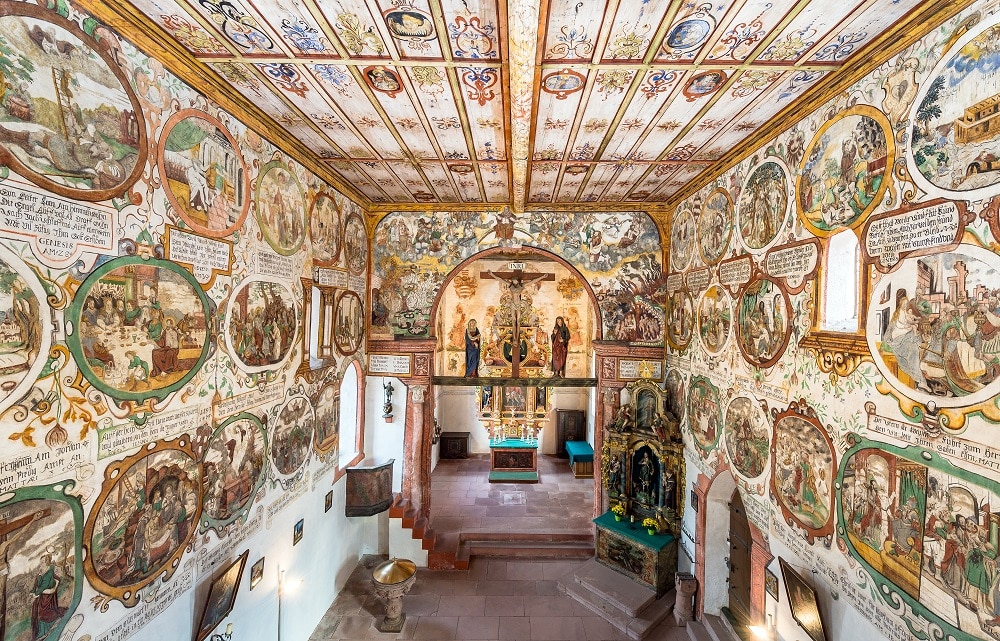
Nr. on the small map: 9 (Bürgstadt) Between the years 900 and 1000, the Martinskapelle was built and most likely used as a parish church for the entire surrounding areas. The door mountings and the main portal were renewed in 1490. On the right hand side of the entrance, there are three conciliation crosses, commonly […]
First Parish Church and Former Church Yard; a Fortified Church

Nr. on the small map: 8 (Bürgstadt) The First Parish Church is favorably picked for weddings and baptisms. Throughout summer, one Holy Mass a week is celebrated. The small door towards the south side is open daily. St. Margareta is very often considered patroness saint in rural communities, as her holiday, July 13th, occurs during […]
Hauptstraße and Freudenberger Straße
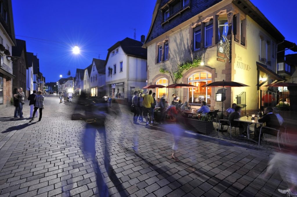
Nr. on the small map: 7 (Bürgstadt) The complex half-timbered houses and the large sandstone arches along the Freudenberger Street, previously named Lauersend, indicate the former wealth of Bürgstadt’s citizens around 1550 to 1750. Thanks to a beltway and the redevelopment of the old town, the Freudenberger Street was remarkably re-evaluated and, with its inviting vintner […]
Town Hall Bürgstadt
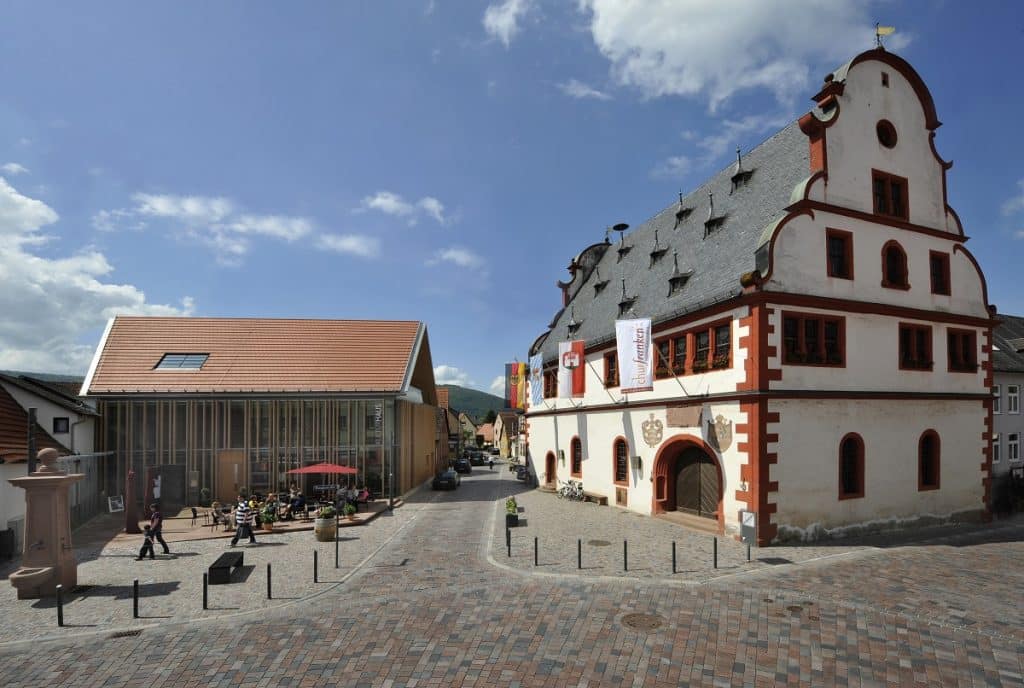
Nr. on the small map: 6 (Bürgstadt) The town hall was built between 1590 and 1592, and decisively shapes the old town. Chronologically and artistically it is strongly connected to the Martinskapelle (St. Martin’s Chapel). It bears witness of wealth: The inscription mentions the precious and costly wine of 1590. The artists Andreas Herneisen and […]